Latitude: 52.4589 / 52°27'32"N
Longitude: 0.0463 / 0°2'46"E
OS Eastings: 539130
OS Northings: 286520
OS Grid: TL391865
Mapcode National: GBR L43.SMM
Mapcode Global: VHHHW.RGBB
Plus Code: 9F42F25W+HG
Entry Name: 97, High Street
Listing Date: 22 March 1983
Grade: II
Source: Historic England
Source ID: 1125980
English Heritage Legacy ID: 47979
ID on this website: 101125980
Location: Chatteris, Fenland, Cambridgeshire, PE16
County: Cambridgeshire
District: Fenland
Civil Parish: Chatteris
Built-Up Area: Chatteris
Traditional County: Cambridgeshire
Lieutenancy Area (Ceremonial County): Cambridgeshire
Church of England Parish: Chatteris St Peter and St Paul
Church of England Diocese: Ely
Tagged with: Building
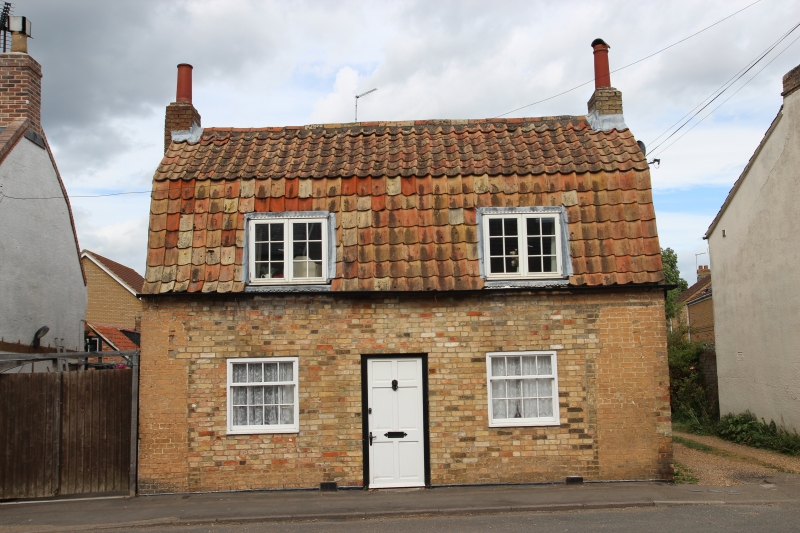
HIGH STREET
1.
5139
No 97
TL 383852 7/22
II GV
2.
Early C19 shop. Two storeys. Gault brick colour-washed, red pantile mansard roof.
End stacks. Two dormers with horizontal sliding sash windows. Shop windows with
plain pilasters and entablature flank central doorway.
Listing NGR: TL3913086520
External links are from the relevant listing authority and, where applicable, Wikidata. Wikidata IDs may be related buildings as well as this specific building. If you want to add or update a link, you will need to do so by editing the Wikidata entry.


Other nearby listed buildings