Latitude: 52.1983 / 52°11'54"N
Longitude: 0.1221 / 0°7'19"E
OS Eastings: 545133
OS Northings: 257689
OS Grid: TL451576
Mapcode National: GBR L7H.1PN
Mapcode Global: VHHK9.20FL
Plus Code: 9F4254XC+8V
Entry Name: 2, Trumpington Street
Listing Date: 2 November 1972
Grade: II
Source: Historic England
Source ID: 1126041
English Heritage Legacy ID: 47840
ID on this website: 101126041
Location: Cambridge, Cambridgeshire, CB2
County: Cambridgeshire
District: Cambridge
Electoral Ward/Division: Market
Parish: Non Civil Parish
Built-Up Area: Cambridge
Traditional County: Cambridgeshire
Lieutenancy Area (Ceremonial County): Cambridgeshire
Church of England Parish: Cambridge St Benedict
Church of England Diocese: Ely
Tagged with: Building
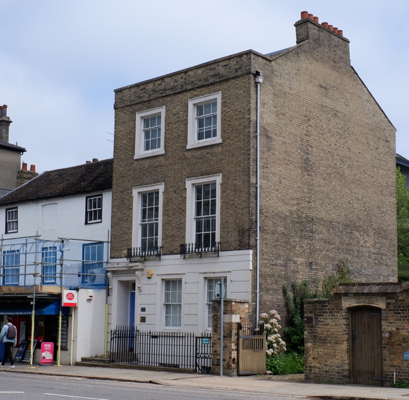
TRUMPINGTON STREET 1. 942 (East Side) No 2 TL 4557 NW 10/693 II 2. Early/Mid C19. Grey gault brick, with rusticated stucco on the ground floor. 3 storeys and basement, 2 windows, sashes with glazing bars, stucco architraves, cast-iron grilles to first floor windows. Panelled door with rectangular light over. Plain cast-iron area railings. Parapet, roof not visible.
Listing NGR: TL4513357689
External links are from the relevant listing authority and, where applicable, Wikidata. Wikidata IDs may be related buildings as well as this specific building. If you want to add or update a link, you will need to do so by editing the Wikidata entry.


Other nearby listed buildings