Latitude: 52.2097 / 52°12'35"N
Longitude: 0.1178 / 0°7'4"E
OS Eastings: 544801
OS Northings: 258949
OS Grid: TL448589
Mapcode National: GBR L79.DLX
Mapcode Global: VHHK3.0Q4C
Plus Code: 9F426459+V4
Entry Name: 31 Thompson's Lane
Listing Date: 2 November 1972
Grade: II
Source: Historic England
Source ID: 1126059
English Heritage Legacy ID: 47793
ID on this website: 101126059
Location: Cambridge, Cambridgeshire, CB5
County: Cambridgeshire
District: Cambridge
Electoral Ward/Division: Market
Parish: Non Civil Parish
Built-Up Area: Cambridge
Traditional County: Cambridgeshire
Lieutenancy Area (Ceremonial County): Cambridgeshire
Church of England Parish: Cambridge St Clement
Church of England Diocese: Ely
Tagged with: Building
This list entry was subject to a Minor Amendment on 20 March 2024 to correct a typo in the description and to reformat the text to current standards
TL 4458 NE
3/176
THOMPSON'S LANE (North Side)
No 31
GV
II
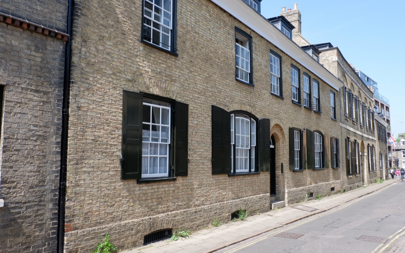
Circa 1820, but not of the same build as No 30. Two storeys gault brick; slate roof; flat stone band with simple moulding above at eaves; six windows, one recess, flush frames, glazing bars; ground floor doorway of two square orders with semi-circular head; two windows, each of three lights, segmental heads and shutters; one single-light window and recess. Brick barrel-vaulting in the cellar. Original staircase and some other contemporary fittings. (RCHM 200.) Nos 29 to 31(consec) form a group.
External links are from the relevant listing authority and, where applicable, Wikidata. Wikidata IDs may be related buildings as well as this specific building. If you want to add or update a link, you will need to do so by editing the Wikidata entry.


Other nearby listed buildings