Approximate Location Map
Large Map »
Latitude: 52.2054 / 52°12'19"N
Longitude: 0.1263 / 0°7'34"E
OS Eastings: 545393
OS Northings: 258485
OS Grid: TL453584
Mapcode National: GBR L79.NRQ
Mapcode Global: VHHK3.4TMP
Plus Code: 9F42644G+5G
Entry Name: 8-12, EMMANUEL ROAD (See details for further address information)
Listing Date: 2 November 1972
Grade: II
Source: Historic England
Source ID: 1126213
English Heritage Legacy ID: 47423
ID on this website: 101126213
Location: Cambridge, Cambridgeshire, CB1
County: Cambridgeshire
District: Cambridge
Electoral Ward/Division: Market
Parish: Non Civil Parish
Built-Up Area: Cambridge
Traditional County: Cambridgeshire
Lieutenancy Area (Ceremonial County): Cambridgeshire
Church of England Parish: Holy Trinity Cambridge
Church of England Diocese: Ely
Tagged with: Building
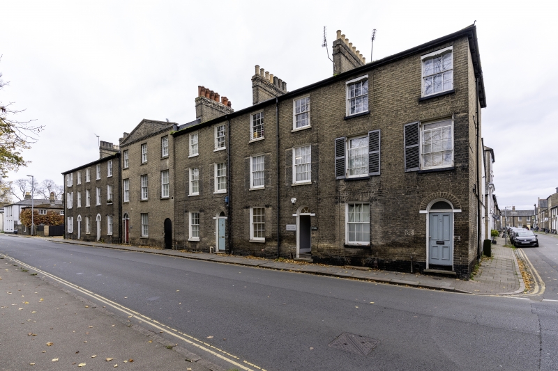
EMMANUEL ROAD
1.
942
Nos 7, 7A & 7B.
Nos 8 to 12 (consec).
TL 4558 NW 4/491
TL 4558 SW 7/491
II
2.
With No 1 Earl Street. Mid C19. Grey gault brick. Uniform block, 2 storeys,
14 windows, 5:3:6, the 3 on No 10 with a pediment at parapet level over.
All windows are sashes with glazing bars. Nos 7, 8 and 9 have external
shutters on the ground and 1st floors. Round headed doorways, No 10 has
an arch through to rear. Hipped slate roof over whole block.
Listing NGR: TL4539358485
External links are from the relevant listing authority and, where applicable, Wikidata. Wikidata IDs may be related buildings as well as this specific building. If you want to add or update a link, you will need to do so by editing the Wikidata entry.


Other nearby listed buildings
