Approximate Location Map
Large Map »
Latitude: 51.5101 / 51°30'36"N
Longitude: -0.1969 / 0°11'49"W
OS Eastings: 525222
OS Northings: 180559
OS Grid: TQ252805
Mapcode National: GBR C8.H10
Mapcode Global: VHGQY.J9RQ
Plus Code: 9C3XGR63+26
Entry Name: 20, Pembridge Gardens
Listing Date: 7 November 1984
Grade: II
Source: Historic England
Source ID: 1126533
English Heritage Legacy ID: 422715
ID on this website: 101126533
Location: Notting Hill, Kensington and Chelsea, London, W2
County: London
District: Kensington and Chelsea
Electoral Ward/Division: Pembridge
Parish: Non Civil Parish
Built-Up Area: Kensington and Chelsea
Traditional County: Middlesex
Lieutenancy Area (Ceremonial County): Greater London
Church of England Parish: St Peter Notting Hill
Church of England Diocese: London
Tagged with: Building
TQ 2580 NW
20/39
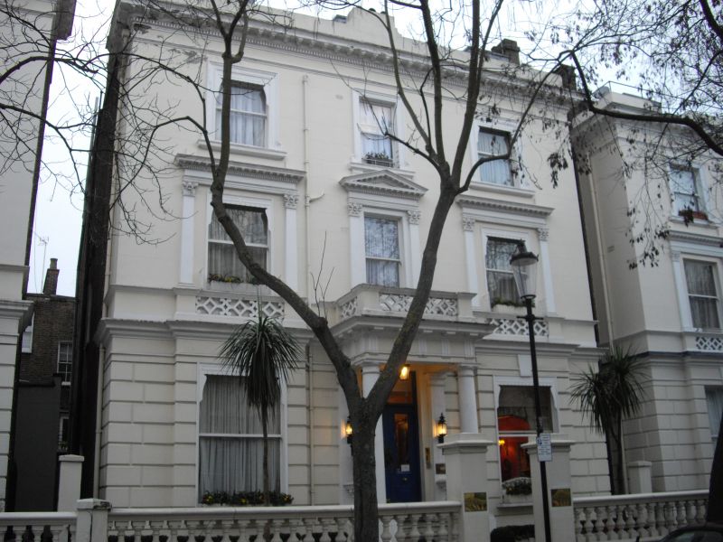
PEMBRIDGE GARDENS W2 (west side)
No 20
GV
II
Detached house. Mid C19. Stucco. Three storeys, three windows wide. Rustication to
ground floor. Central Doric porch. Pediments to first floor windows. Good garden
walls and gatepiers.
Part of unified scheme with Nos 1-29, 2-18, 20-34 and Pembridge Square.
Listing NGR: TQ2522280559
External links are from the relevant listing authority and, where applicable, Wikidata. Wikidata IDs may be related buildings as well as this specific building. If you want to add or update a link, you will need to do so by editing the Wikidata entry.


Other nearby listed buildings
