Approximate Location Map
Large Map »
Latitude: 52.6637 / 52°39'49"N
Longitude: 0.1611 / 0°9'39"E
OS Eastings: 546248
OS Northings: 309521
OS Grid: TF462095
Mapcode National: GBR L1Q.ZHD
Mapcode Global: WHJPH.F9YS
Plus Code: 9F42M576+FC
Entry Name: Boundary Wall to Vicarage and Sunday School
Listing Date: 31 October 1983
Grade: II
Source: Historic England
Source ID: 1126685
English Heritage Legacy ID: 48265
ID on this website: 101126685
Location: Wisbech, Fenland, Cambridgeshire, PE13
County: Cambridgeshire
District: Fenland
Civil Parish: Wisbech
Built-Up Area: Wisbech
Traditional County: Cambridgeshire
Lieutenancy Area (Ceremonial County): Cambridgeshire
Church of England Parish: Wisbech St Peter and St Paul
Church of England Diocese: Ely
Tagged with: Wall
WISBECH LOVE LANE
TF 4609
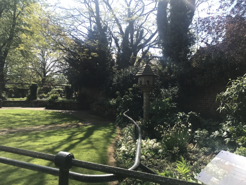
6/68 8/68 Boundary wall to
Vicarage and
Sunday School
GV II
C17 and C18 red brick wall, contemporary with the C17 castle and
marking in Love Lane, the outer perimeter of the moated
mediaeval Castle site.
VCH Cambs, p.242.
Listing NGR: TF4624809521
External links are from the relevant listing authority and, where applicable, Wikidata. Wikidata IDs may be related buildings as well as this specific building. If you want to add or update a link, you will need to do so by editing the Wikidata entry.


Other nearby listed buildings
