Approximate Location Map
Large Map »
Latitude: 52.6606 / 52°39'38"N
Longitude: -0.3371 / 0°20'13"W
OS Eastings: 512568
OS Northings: 308287
OS Grid: TF125082
Mapcode National: GBR GX8.5LK
Mapcode Global: WHGLZ.SDP4
Plus Code: 9C4XMM67+75
Entry Name: 19, West End Road
Listing Date: 24 February 1982
Grade: II
Source: Historic England
Source ID: 1126725
English Heritage Legacy ID: 50185
ID on this website: 101126725
Location: Maxey, Peterborough, Cambridgeshire, PE6
County: City of Peterborough
Civil Parish: Maxey
Built-Up Area: Maxey
Traditional County: Northamptonshire
Lieutenancy Area (Ceremonial County): Cambridgeshire
Church of England Parish: Maxey St Peter
Church of England Diocese: Peterborough
Tagged with: Building Thatched cottage
1.
5141
TF 1208
25/398
MAXEY
WEST END ROAD
(north side)
No 19
II
2.
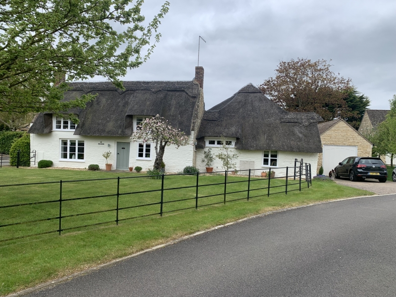
C17/18 cottage at right angles to road. Stone rubble with plastered front.
Thatched roof with coped gable ends. One storey and attic. Two window
range. Modern casements. Two eyebrow dormers. Central modern porch.
Brick end chimney stacks.
Listing NGR: TF1256808287
External links are from the relevant listing authority and, where applicable, Wikidata. Wikidata IDs may be related buildings as well as this specific building. If you want to add or update a link, you will need to do so by editing the Wikidata entry.


Other nearby listed buildings
