Approximate Location Map
Large Map »
Latitude: 52.5728 / 52°34'22"N
Longitude: -0.2466 / 0°14'47"W
OS Eastings: 518927
OS Northings: 298663
OS Grid: TL189986
Mapcode National: GBR HZP.QGV
Mapcode Global: WHHNK.5LVH
Plus Code: 9C4XHQF3+49
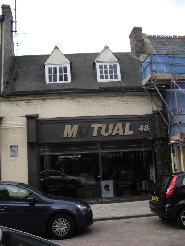
Entry Name: 48, Cowgate
Listing Date: 7 May 1973
Grade: II
Source: Historic England
Source ID: 1126958
English Heritage Legacy ID: 49611
ID on this website: 101126958
Location: Peterborough, Cambridgeshire, PE1
County: City of Peterborough
Electoral Ward/Division: Central
Parish: Non Civil Parish
Built-Up Area: Peterborough
Traditional County: Northamptonshire
Lieutenancy Area (Ceremonial County): Cambridgeshire
Church of England Parish: Peterborough St John the Baptist
Church of England Diocese: Peterborough
Tagged with: Building
PETERBOROUGH
1.
1500
COWGATE
(South Side )
No 48
TL 1898 NE 4/112
II GV
2.
Early C19. Brick. Slate roof. 1 storey and attics. 2 gabled dormers,
flush framed casements with glazing bars. Modern ground floor shop front.
Nos 42 to 50 (even) form a group.
Listing NGR: TL1892798663
External links are from the relevant listing authority and, where applicable, Wikidata. Wikidata IDs may be related buildings as well as this specific building. If you want to add or update a link, you will need to do so by editing the Wikidata entry.


Other nearby listed buildings
