Latitude: 52.3305 / 52°19'49"N
Longitude: -0.1851 / 0°11'6"W
OS Eastings: 523770
OS Northings: 271820
OS Grid: TL237718
Mapcode National: GBR J2P.VD3
Mapcode Global: VHGLW.RP09
Plus Code: 9C4X8RJ7+6X
Entry Name: Walden House
Listing Date: 10 January 1951
Grade: II*
Source: Historic England
Source ID: 1128590
English Heritage Legacy ID: 53649
ID on this website: 101128590
Location: Huntingdon, Huntingdonshire, Cambridgeshire, PE29
County: Cambridgeshire
District: Huntingdonshire
Civil Parish: Huntingdon
Built-Up Area: Huntingdon
Traditional County: Huntingdonshire
Lieutenancy Area (Ceremonial County): Cambridgeshire
Church of England Parish: Huntingdon All Saints with St John the Baptist
Church of England Diocese: Ely
Tagged with: House
Huntingdon MARKET HILL 1. ----------- 5140 Walden House TL 2371 2/19 10.1.51. II* GV
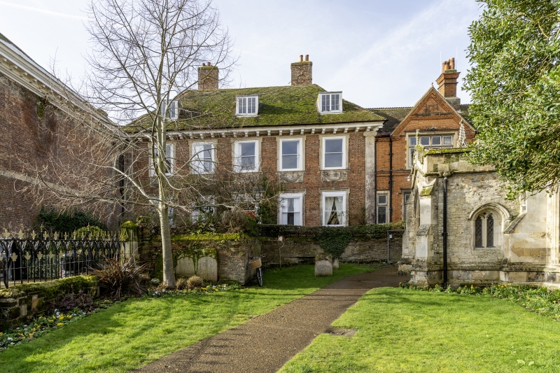
2. Late C17. 2 storeys with dormers, red brick, stone dressings, Ionic pilasters at either end of front. 5 windows with carved architraves, with swags on aprons below those end floor. Sshes, no glazing bars, modillioned cornice. Later door, probably early C19, 6-panel, plain pilastered surround, with dentil cornice. Elaborate C18 fanlight. Hipped tile roof with 3 flat-topped dormers, big brick stack with keyed recessed niches. (RCHM 13).
Listing NGR: TL2377071820
External links are from the relevant listing authority and, where applicable, Wikidata. Wikidata IDs may be related buildings as well as this specific building. If you want to add or update a link, you will need to do so by editing the Wikidata entry.


Other nearby listed buildings