Latitude: 51.4438 / 51°26'37"N
Longitude: -2.7338 / 2°44'1"W
OS Eastings: 349096
OS Northings: 171897
OS Grid: ST490718
Mapcode National: GBR JJ.NC1L
Mapcode Global: VH88K.KZL2
Plus Code: 9C3VC7V8+GF
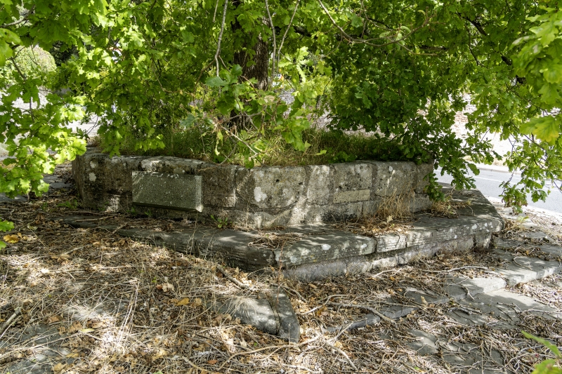
Entry Name: Remains of Village Cross at NGR St 4910 7190, at Junction of Wraxhall Hill and Clevedon Road
Listing Date: 16 March 1984
Grade: II
Source: Historic England
Source ID: 1129056
English Heritage Legacy ID: 33594
ID on this website: 101129056
Location: Wraxall, North Somerset, BS48
County: North Somerset
Civil Parish: Wraxall and Failand
Traditional County: Somerset
Lieutenancy Area (Ceremonial County): Somerset
Tagged with: Building High cross
This list entry was subject to a Minor Amendment on 8 May 2024 to amend the name and address and reformat the text to current standards
ST 47 SE
3/203
WRAXALL
WRAXALL HILL (west side)
Remains of Village Cross at NGR ST 4910 7190 at Junction with Clevedon Road
II
Remains of village cross. C15. Ashlar. Octagonal base survives, from approximately one to two feet high.
Listing NGR: ST4910071900
External links are from the relevant listing authority and, where applicable, Wikidata. Wikidata IDs may be related buildings as well as this specific building. If you want to add or update a link, you will need to do so by editing the Wikidata entry.


Other nearby listed buildings