Approximate Location Map
Large Map »
Latitude: 51.3607 / 51°21'38"N
Longitude: -2.7619 / 2°45'42"W
OS Eastings: 347047
OS Northings: 162675
OS Grid: ST470626
Mapcode National: GBR JH.THZD
Mapcode Global: VH894.22R7
Plus Code: 9C3V966Q+76
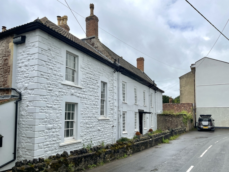
Entry Name: Webbsbrook House
Listing Date: 9 February 1961
Grade: II
Source: Historic England
Source ID: 1129226
English Heritage Legacy ID: 34021
ID on this website: 101129226
Location: Wrington, North Somerset, BS40
County: North Somerset
Civil Parish: Wrington
Built-Up Area: Wrington
Traditional County: Somerset
Lieutenancy Area (Ceremonial County): Somerset
Tagged with: House
ST 46 SE WRINGTON C.P. SILVER STREET (south side)
5/155 Webbsbrook House
9.2.61
G.V. II
Detached house. Early C18. Limewashed stucco with raised rusticated quoins,
stone copings and triple Roman tile roof. 2-storey, 4-window north-east front.
All windows are 18-pane sashes with thick glazing bars. Central doorway with
flat hood and 4-panel door. Wide moulded eaves cornice, double span roof and end
brick stacks. Later extension to right-hand.
Listing NGR: ST4704762675
External links are from the relevant listing authority and, where applicable, Wikidata. Wikidata IDs may be related buildings as well as this specific building. If you want to add or update a link, you will need to do so by editing the Wikidata entry.


Other nearby listed buildings
