Latitude: 51.553 / 51°33'10"N
Longitude: -2.2924 / 2°17'32"W
OS Eastings: 379820
OS Northings: 183828
OS Grid: ST798838
Mapcode National: GBR 0NG.P6L
Mapcode Global: VH95W.67YB
Plus Code: 9C3VHP35+52
Entry Name: Lower Slait Lodge
Listing Date: 17 September 1952
Grade: II*
Source: Historic England
Source ID: 1129323
English Heritage Legacy ID: 34244
ID on this website: 101129323
Location: Little Badminton, South Gloucestershire, GL9
County: South Gloucestershire
Civil Parish: Badminton
Traditional County: Gloucestershire
Lieutenancy Area (Ceremonial County): Gloucestershire
Church of England Parish: Badminton St Michael and All Angels
Church of England Diocese: Gloucester
Tagged with: Gatehouse
BADMINTON C.P. BADMINTON PARK ST 78 SE
6/35 Lower Slait Lodge
17.9.52 - II *
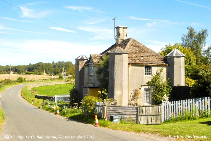
Lodge. Circa 1750. Probably by Thomas Wright of Durham. Rendered; hipped slate roof; central octagonal stack with parapet. Gothick. 2 storeys. 4 hexagonal corner turrets with hexagonal slate roofs. 2 windows and central door: 2-light casements with decorative leaded glazing; C20 projecting porch.
Listing NGR: ST7982083828
External links are from the relevant listing authority and, where applicable, Wikidata. Wikidata IDs may be related buildings as well as this specific building. If you want to add or update a link, you will need to do so by editing the Wikidata entry.


Other nearby listed buildings