Approximate Location Map
Large Map »
Latitude: 51.5833 / 51°34'59"N
Longitude: -2.3253 / 2°19'31"W
OS Eastings: 377555
OS Northings: 187208
OS Grid: ST775872
Mapcode National: GBR 0N1.LY3
Mapcode Global: VH95N.NG1M
Plus Code: 9C3VHMMF+8V
Entry Name: Upton House
Listing Date: 10 November 1983
Grade: II
Source: Historic England
Source ID: 1129363
English Heritage Legacy ID: 34346
ID on this website: 101129363
Location: The Barton, South Gloucestershire, GL9
County: South Gloucestershire
Civil Parish: Hawkesbury
Built-Up Area: Hawkesbury Upton
Traditional County: Gloucestershire
Lieutenancy Area (Ceremonial County): Gloucestershire
Church of England Parish: Hawkesbury St Mary
Church of England Diocese: Gloucester
Tagged with: House
HAWKESBURY C.P. HIGH STREET (south west
ST 78 NE side)
HAWKESBURY UPTON
4/133
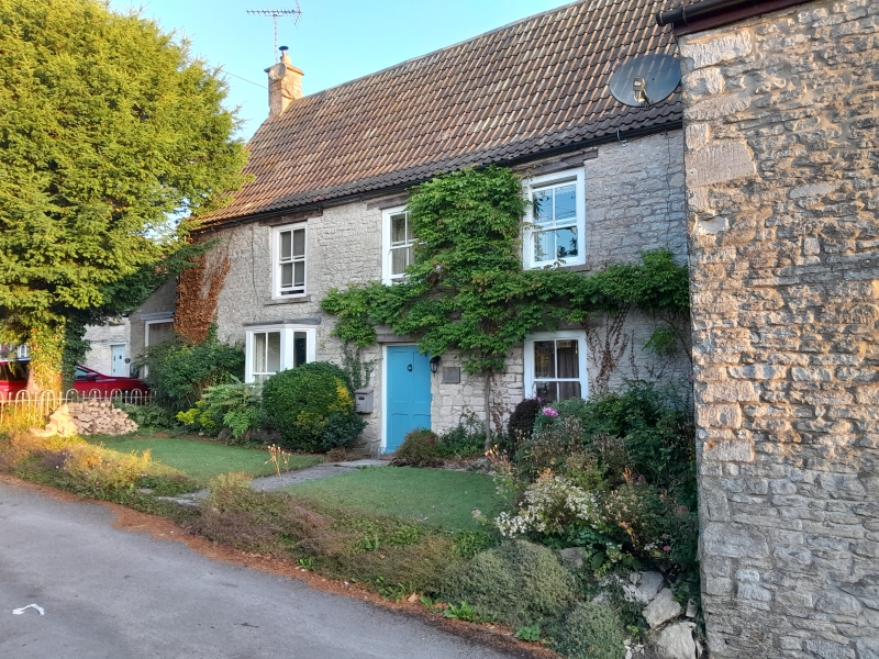
Upton House
- II
House. Remodelled mid C19th. Rubble; C20th tiled roof. 2 storeys.
3 bays, 4-pane sash windows, bay on ground floor to left. Central 4 panel door.
Listing NGR: ST7755587208
External links are from the relevant listing authority and, where applicable, Wikidata. Wikidata IDs may be related buildings as well as this specific building. If you want to add or update a link, you will need to do so by editing the Wikidata entry.


Other nearby listed buildings
