Latitude: 51.4358 / 51°26'8"N
Longitude: -2.6436 / 2°38'36"W
OS Eastings: 355357
OS Northings: 170949
OS Grid: ST553709
Mapcode National: GBR JN.NXBC
Mapcode Global: VH88T.458N
Plus Code: 9C3VC9P4+8H
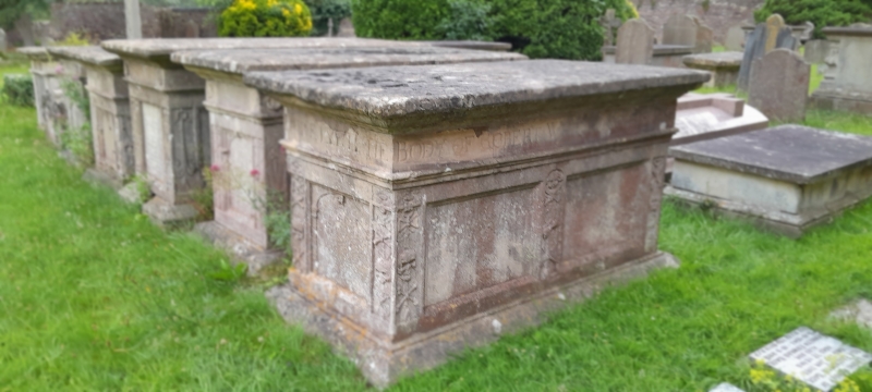
Entry Name: Monument to Robert Whiting, 1662, in the Churchyard to South of All Saints' Church
Listing Date: 16 March 1984
Grade: II*
Source: Historic England
Source ID: 1129847
English Heritage Legacy ID: 33505
ID on this website: 101129847
Location: All Saints' Church, North Somerset, BS41
County: North Somerset
Civil Parish: Long Ashton
Built-Up Area: Long Ashton
Traditional County: Somerset
Lieutenancy Area (Ceremonial County): Somerset
Tagged with: Monument
ST 57 SE LONG ASHTON CHURCH ROAD (south-east side)
5/109 Monument to Robert Whiting, 1662, in the Churchyard to south of All G.V. Saints Church
II*
Chest tomb. Robert Whiting, died 1662. Limestone ashlar. Sunken square panels; enriched pilasters with memento mori; inscribed frieze; moulded plinth and cornice. One of a very important group of family chest tombs with Renaissance details.
Listing NGR: ST5535770949
External links are from the relevant listing authority and, where applicable, Wikidata. Wikidata IDs may be related buildings as well as this specific building. If you want to add or update a link, you will need to do so by editing the Wikidata entry.


Other nearby listed buildings