Latitude: 52.5499 / 52°32'59"N
Longitude: -0.3291 / 0°19'44"W
OS Eastings: 513393
OS Northings: 295983
OS Grid: TL133959
Mapcode National: GBR GYN.1MB
Mapcode Global: VHGKV.75WL
Plus Code: 9C4XGMXC+X9
Entry Name: 12 14, Church Street
Listing Date: 13 December 1951
Grade: II
Source: Historic England
Source ID: 1130082
English Heritage Legacy ID: 54819
ID on this website: 101130082
Location: Alwalton, Huntingdonshire, Cambridgeshire, PE7
County: Cambridgeshire
District: Huntingdonshire
Civil Parish: Alwalton
Built-Up Area: Peterborough
Traditional County: Huntingdonshire
Lieutenancy Area (Ceremonial County): Cambridgeshire
Church of England Parish: Alwalton
Church of England Diocese: Ely
Tagged with: Building
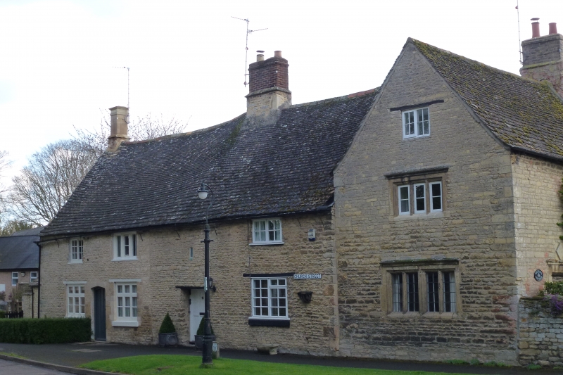
ALWALTON CHURCH STREET TL 1295 TL 19 NW (East Side) 3/9 2/9 Nos. 12 and 14 13.12.51 GV II
Two dwellings, formerly one house or farmhouse. Mid to late C17 with some rebuilding and late C19 alteration. Coursed limestone rubble with freestone and ashlar dressings, Collyweston stone slated roof. Large ridge stack to right of centre with upper stage rebuilt in brick; ashlar end stack with one flue to left hand, and end stack to left hand range. Two storeys with single storey range to left hand. Original three unit plan modified. C19 boarded door (No. 14) to left hand with shallow pointed arch, and one C20 recessed six-panelled door (No. 12) in wide opening to right hand with small blocked rectangular light above; two ground floor transomed three-light casement windows and one C20 casement window to right hand, and one three-light chamfered mullioned window.
Enclosure Award Map. 1809. H.R.O.
Listing NGR: TL1339395983
External links are from the relevant listing authority and, where applicable, Wikidata. Wikidata IDs may be related buildings as well as this specific building. If you want to add or update a link, you will need to do so by editing the Wikidata entry.


Other nearby listed buildings