Latitude: 51.1281 / 51°7'41"N
Longitude: -2.3016 / 2°18'5"W
OS Eastings: 378987
OS Northings: 136575
OS Grid: ST789365
Mapcode National: GBR 0TP.6XL
Mapcode Global: VH97T.2X23
Plus Code: 9C3V4MHX+68
Entry Name: Granary at Manor Farm
Listing Date: 9 September 1987
Grade: II
Source: Historic England
Source ID: 1131156
English Heritage Legacy ID: 321186
ID on this website: 101131156
Location: Norton Ferris, Wiltshire, BA12
County: Wiltshire
Civil Parish: Kilmington
Traditional County: Somerset
Lieutenancy Area (Ceremonial County): Wiltshire
Church of England Parish: Upper Stour
Church of England Diocese: Salisbury
Tagged with: Granary
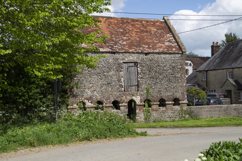
KILMINGTON NORTON FERRIS ST 73 NE (east side) 3/80 Granary at Manor Farm II Granary. Probably late C18. Random rubblestone with brick dressings, tiled roof with coped verges. Rectangular structure raised on brick arches with stone imposts; seven on long sides and four to gable ends. Planked doors to front and rear and shuttered window and blocked loft opening to both gable ends. Very similar to the granary in the stable yard at Stourhead (q.v.).
Listing NGR: ST7898736575
External links are from the relevant listing authority and, where applicable, Wikidata. Wikidata IDs may be related buildings as well as this specific building. If you want to add or update a link, you will need to do so by editing the Wikidata entry.


Other nearby listed buildings