Latitude: 54.3904 / 54°23'25"N
Longitude: -1.6518 / 1°39'6"W
OS Eastings: 422709
OS Northings: 499493
OS Grid: SE227994
Mapcode National: GBR JKXN.6X
Mapcode Global: WHC6F.LXN3
Plus Code: 9C6W98RX+57
Entry Name: Farm Buildings at Bridge Farm to South of Farmhouse
Listing Date: 6 November 1986
Grade: II
Source: Historic England
Source ID: 1131591
English Heritage Legacy ID: 322069
ID on this website: 101131591
Location: Catterick Bridge, North Yorkshire, DL10
County: North Yorkshire
District: Richmondshire
Civil Parish: Brompton-on-Swale
Built-Up Area: Brompton-on-Swale
Traditional County: Yorkshire
Lieutenancy Area (Ceremonial County): North Yorkshire
Church of England Parish: Easby with Brompton on Swale and Bolton on Swale
Church of England Diocese: Leeds
Tagged with: Agricultural structure
SE 29 NW
8/137
BROMPTON ON SWALE
GATHERLEY ROAD
(east side)
Farm buildings at Bridge Farm to South of farmhouse
GV
II
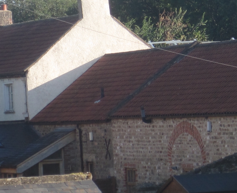
Farmyard building. Early and mid C19. Sandstone and river cobble with some brick
dressings, sandstone and pantile roof, some corrugated metal replacement. Ranges
round 3 sides of yard open to south. Differing rooflines and probably different
construction dates but more or less comtemporary with the farmhouse, homogenous in
character and all of small scale. The west range fronting the road has the sandstone
roof and is especially visually valuable. Included for group value with the
farmhouse at Catterick Bridge.
Listing NGR: SE2270999493
External links are from the relevant listing authority and, where applicable, Wikidata. Wikidata IDs may be related buildings as well as this specific building. If you want to add or update a link, you will need to do so by editing the Wikidata entry.


Other nearby listed buildings