Latitude: 54.4036 / 54°24'12"N
Longitude: -1.7198 / 1°43'11"W
OS Eastings: 418289
OS Northings: 500940
OS Grid: NZ182009
Mapcode National: GBR JKFJ.G6
Mapcode Global: WHC6D.KK8Z
Plus Code: 9C6WC73J+C3
Entry Name: Boundary Stone Approximately 1 Metre East of Scots Dyke
Listing Date: 6 November 1986
Grade: II
Source: Historic England
Source ID: 1131604
English Heritage Legacy ID: 322098
ID on this website: 101131604
Location: Anchorage Hill, North Yorkshire, DL10
County: North Yorkshire
District: Richmondshire
Civil Parish: Easby
Traditional County: Yorkshire
Lieutenancy Area (Ceremonial County): North Yorkshire
Church of England Parish: Easby with Brompton on Swale and Bolton on Swale
Church of England Diocese: Leeds
Tagged with: Boundary marker
NZ 10 SE
4/32
EASBY
B 6271
(north side)
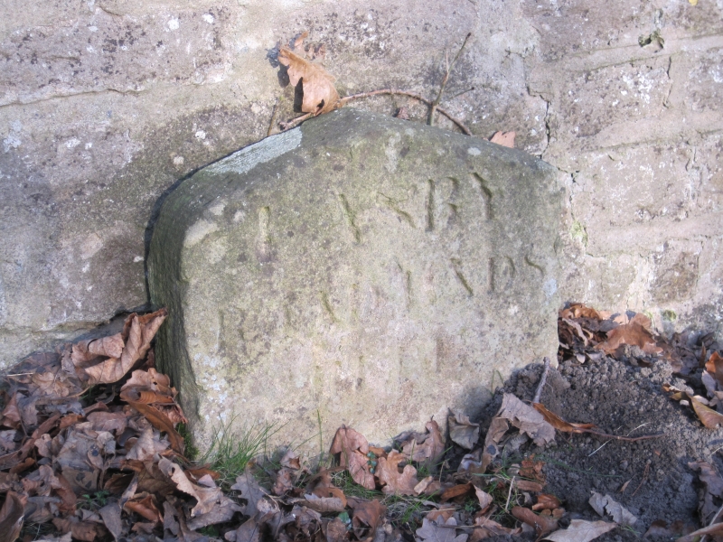
Boundary Stone approximately 1 metre east of Scots Dyke
II
Boundary stone. Late C18 - early C19. Sandstone ashlar. Stone
approximately 300mm wide, 400mm high, and with four-centred arched top.
Inscribed on front face "EASBY ROAD ENDS HERE". Marks the ancient boundary
between the parish of Easby and the Borough of Richmond.
Listing NGR: NZ1828900940
External links are from the relevant listing authority and, where applicable, Wikidata. Wikidata IDs may be related buildings as well as this specific building. If you want to add or update a link, you will need to do so by editing the Wikidata entry.


Other nearby listed buildings