Latitude: 53.9828 / 53°58'58"N
Longitude: -1.8913 / 1°53'28"W
OS Eastings: 407222
OS Northings: 454089
OS Grid: SE072540
Mapcode National: GBR HQ7D.B0
Mapcode Global: WHB79.X5J1
Plus Code: 9C5WX4M5+4F
Entry Name: Aqueduct North of the Abbey Mill
Listing Date: 10 September 1954
Grade: II
Source: Historic England
Source ID: 1131773
English Heritage Legacy ID: 323719
ID on this website: 101131773
Location: Bolton Abbey, North Yorkshire, BD23
County: North Yorkshire
District: Craven
Civil Parish: Bolton Abbey
Traditional County: Yorkshire
Lieutenancy Area (Ceremonial County): North Yorkshire
Tagged with: Aqueduct
BOLTON ABBEY B 6160 SE 05 SE
8/65 Aqueduct north of the Abbey mill
10.9.54
GV II
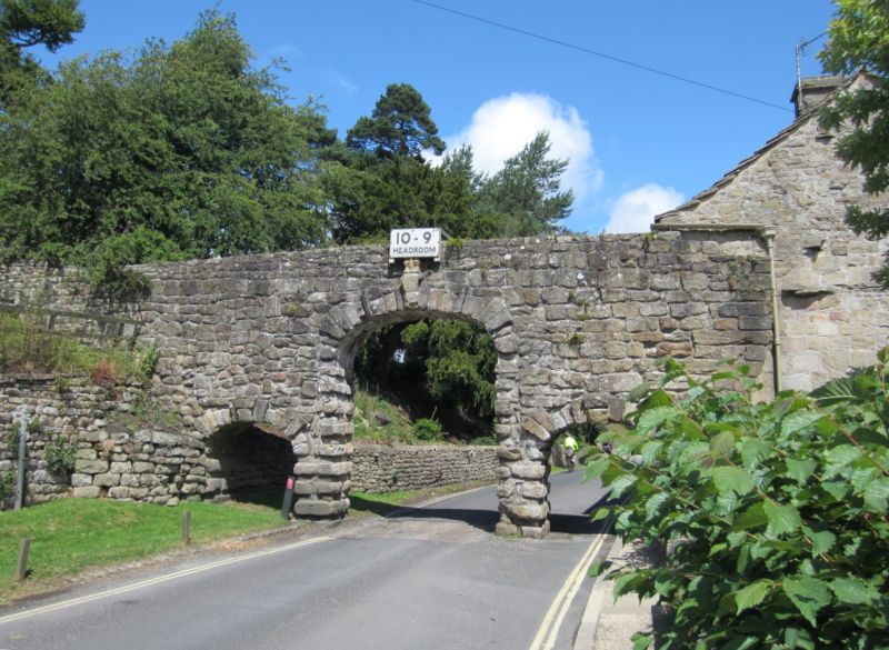
Aqueduct. C18. Coursed, squared stone. 3 rusticated segmental-headed arches cross the Bolton to Barden road, the central one being larger and approximately 3 metres in height.
Listing NGR: SE0722254089
External links are from the relevant listing authority and, where applicable, Wikidata. Wikidata IDs may be related buildings as well as this specific building. If you want to add or update a link, you will need to do so by editing the Wikidata entry.


Other nearby listed buildings