Latitude: 53.9606 / 53°57'38"N
Longitude: -2.0198 / 2°1'11"W
OS Eastings: 398799
OS Northings: 451614
OS Grid: SD987516
Mapcode National: GBR GQBM.JZ
Mapcode Global: WHB77.YQC2
Plus Code: 9C5VXX6J+63
Entry Name: The Barge Inn
Listing Date: 2 March 1978
Grade: II
Source: Historic England
Source ID: 1131868
English Heritage Legacy ID: 323433
ID on this website: 101131868
Location: Skipton, North Yorkshire, BD23
County: North Yorkshire
District: Craven
Civil Parish: Skipton
Built-Up Area: Skipton
Traditional County: Yorkshire
Lieutenancy Area (Ceremonial County): North Yorkshire
Tagged with: Inn
1. 5336 COACH STREET
The Barge Inn SD 9851 1/33
II GV
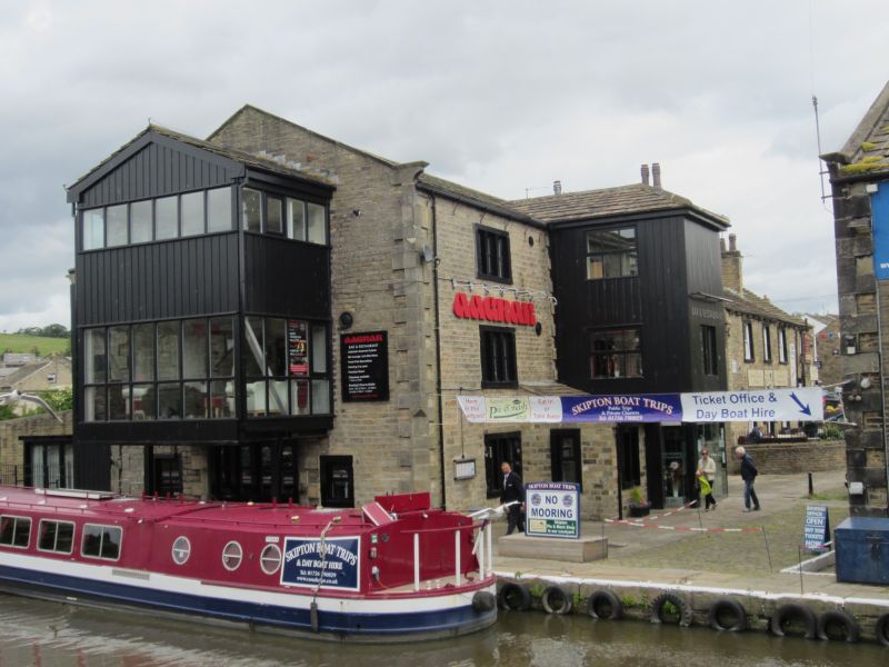
2. Formerly a warehouse. Late C18 stone rubble, quoins, stone flag roof, stone copings and kneelers. 3 storeys. A 3-light stone mullioned window on each floor at each side of a modern painted brick and glass projection for staircase and entrance.
Listing NGR: SD9879951614
External links are from the relevant listing authority and, where applicable, Wikidata. Wikidata IDs may be related buildings as well as this specific building. If you want to add or update a link, you will need to do so by editing the Wikidata entry.


Other nearby listed buildings