Approximate Location Map
Large Map »
Latitude: 54.0348 / 54°2'5"N
Longitude: -2.2001 / 2°12'0"W
OS Eastings: 386988
OS Northings: 459890
OS Grid: SD869598
Mapcode National: GBR FP2S.GC
Mapcode Global: WHB6S.5VK6
Plus Code: 9C6V2QMX+WW
Entry Name: Limekiln at Ormsgill Green
Listing Date: 31 May 1989
Grade: II
Source: Historic England
Source ID: 1132109
English Heritage Legacy ID: 324890
ID on this website: 101132109
Location: North Yorkshire, BD23
County: North Yorkshire
District: Craven
Civil Parish: Airton
Traditional County: Yorkshire
Lieutenancy Area (Ceremonial County): North Yorkshire
Church of England Parish: Kirkby-in-Malhamdale St Michael the Archangel
Church of England Diocese: Leeds
Tagged with: Lime kiln
AIRTON ORMS GILL GREEN LANE
SD 85 NE
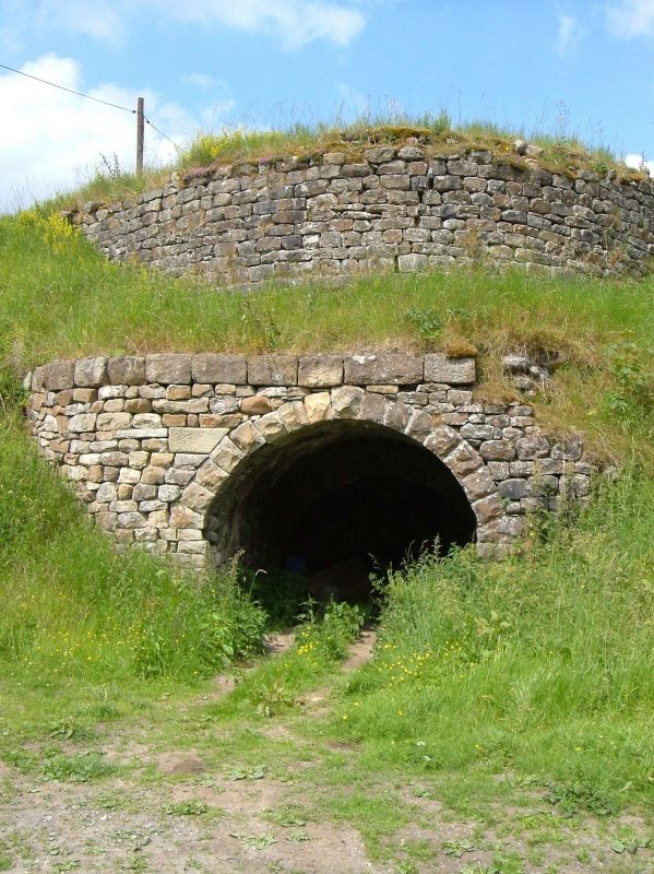
2/13 Limekiln at Ormsgill
Green
GV II
Limekiln, probably C19. The visible part consists of a rubble arch in a
relieving wall, coped with larger stones, and a curved upper wall also of
rubble.
Listing NGR: SD8698859890
External links are from the relevant listing authority and, where applicable, Wikidata. Wikidata IDs may be related buildings as well as this specific building. If you want to add or update a link, you will need to do so by editing the Wikidata entry.


Other nearby listed buildings
