Latitude: 54.106 / 54°6'21"N
Longitude: -2.0402 / 2°2'24"W
OS Eastings: 397470
OS Northings: 467791
OS Grid: SD974677
Mapcode National: GBR GN6Y.3W
Mapcode Global: WHB6N.M2P3
Plus Code: 9C6V4X45+CW
Entry Name: Angler's Cottage
Listing Date: 4 May 1989
Grade: II
Source: Historic England
Source ID: 1132217
English Heritage Legacy ID: 324641
ID on this website: 101132217
Location: Kilnsey, North Yorkshire, BD23
County: North Yorkshire
District: Craven
Civil Parish: Conistone with Kilnsey
Traditional County: Yorkshire
Lieutenancy Area (Ceremonial County): North Yorkshire
Tagged with: Cottage
This list entry was subject to a Minor Amendment on 14 May 2025 to reformat the text to current standards.
SD 9767
23/54
CONISTONE WITH KILNSEY
Kilnsey
B6160 (west side)
Angler's Cottage
GV
II
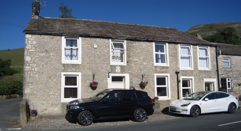
Inn, now house and holiday cottage. 1768 with late C19 alterations. Coursed limestone rubble, ashlar dressings, graduated stone slate roof. Quoins. Two storeys, five bays, symmetrical facade to left, the right hand two bays narrower. C20 door and plain overlight bay two in sawn stone surround, a stone plaque above with a round-headed recess and letters in relief: " 0 ", C20 door far right in chamfered quoined surround. To right of H E 1768 the main entrance, bay two, a blocked doorway has the letters "0" and "1754" crudely incised on the right jamb.
Fenestration: rectangular windows in plain stone surrounds throughout, with C20 casements to ground floor bays three and four, and four-pane sashes elsewhere. Window to bay four ground floor is smaller than those to first three bays and those to bays four and five are larger. End stacks.
Interior: the blocked front doorway has a fine built-in shelf unit of mid-late C18 type, with shaped shelves and shell hood.
The building was the Angler's Inn, established in 1760 (Speight p.470) and the landlord was John Inman. One Henry Ovington lived at the inn in 1797 when a meeting of landowners took place to discuss the enclosure of the land in the area (Baistrick p 54). In 1882 the licence was given up, the property then owned by Mr. Tennant of Chapel House (q.v.),and the nearby Tennant Arms was established.
Listing NGR: SD9747067791
External links are from the relevant listing authority and, where applicable, Wikidata. Wikidata IDs may be related buildings as well as this specific building. If you want to add or update a link, you will need to do so by editing the Wikidata entry.


Other nearby listed buildings