Approximate Location Map
Large Map »
Latitude: 53.7834 / 53°47'0"N
Longitude: -1.0725 / 1°4'20"W
OS Eastings: 461210
OS Northings: 432300
OS Grid: SE612323
Mapcode National: GBR NSYP.LH
Mapcode Global: WHFD2.H5HC
Plus Code: 9C5WQWMH+92
Entry Name: 53 and 55, Gowthorpe
Listing Date: 14 November 1980
Grade: II
Source: Historic England
Source ID: 1132571
English Heritage Legacy ID: 325748
ID on this website: 101132571
Location: Selby, North Yorkshire, YO8
County: North Yorkshire
District: Selby
Civil Parish: Selby
Built-Up Area: Selby
Traditional County: Yorkshire
Lieutenancy Area (Ceremonial County): North Yorkshire
Church of England Parish: Selby St James
Church of England Diocese: York
Tagged with: Building
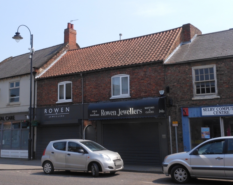
GOWTHORPE
1. (south side)
5342 ------------
Nos 53 and 55
SE 6132 SW 4/65
II GV
2.
Early C19. Brown brick. Pitched pantile roof. Two storeys. Two segment-
headed casements on first floor. One round-arched passage entrance and 2
modern shop-fronts.
Listing NGR: SE6121032299
External links are from the relevant listing authority and, where applicable, Wikidata. Wikidata IDs may be related buildings as well as this specific building. If you want to add or update a link, you will need to do so by editing the Wikidata entry.


Other nearby listed buildings
