Latitude: 50.6111 / 50°36'39"N
Longitude: -2.4537 / 2°27'13"W
OS Eastings: 367994
OS Northings: 79138
OS Grid: SY679791
Mapcode National: GBR PY.D9H9
Mapcode Global: FRA 57RG.7WL
Plus Code: 9C2VJG6W+CG
Entry Name: Black Dog Public House
Listing Date: 18 June 1970
Grade: II*
Source: Historic England
Source ID: 1132631
English Heritage Legacy ID: 467888
ID on this website: 101132631
Location: Melcombe Regis, Dorset, DT4
County: Dorset
Electoral Ward/Division: Melcombe Regis
Parish: Weymouth
Built-Up Area: Weymouth
Traditional County: Dorset
Lieutenancy Area (Ceremonial County): Dorset
Church of England Parish: Radipole and Melcombe Regis
Church of England Diocese: Salisbury
Tagged with: Pub
WEYMOUTH
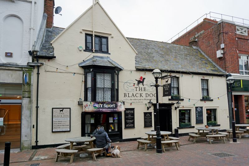
SY6779SE ST MARY STREET 873-1/20/290 (East side) 18/06/70 No.3 Black Dog Public House
GV II*
Inn. Late C16 and C17. Rendered, some timber-framing, slate roof. The later front range, in St Mary Street backs on 2 ranges with a narrow central courtyard, and the whole is now enclosed to the rear by buildings in Charlotte Place. EXTERIOR: 2 storeys, attic and basement. The front has a wide flush gable to the left with a 3-light stone mullioned casement under a stopped label course, above a canted C19 oriel with slated hipped roof and plain sashes to pilaster mullions, with small panelled skirt. Ground floor has a display window. To the right the eaves roof has two 4-pane sashes at each level, in reveals and with moulded architraves; the ground floor lights are almost square. To the left is a fine panelled door in a pilaster doorcase with frieze and cornice; the floor is below present pavement level. Plinth, and brick stack to each gable end. The face gable has a saddle-back coping with a finial base, on modelled kneelers. The rear is concealed by later buildings, but there is an access through a narrow passageway from Charlotte Place to an early panelled door. INTERIOR: the ground floor, lower than the street, is of low pitch. At the rear, left, is a tight wooden winder staircase, and a wall in large stone block, incorporating a chamfered beam. The front right room has a beam with rough chamfer, and there are various early joists. The rear left has a wide bressumer fireplace with lamb's tongue stops on chamfered stone jambs, and there is a stone 4-light recessed hollow-mould mullion casement, no longer on an external wall. The rear courtyard is stone-paved. The first floor has (RCHME) a bolection-mould fireplace surround, above which are three C17 plaster panels, and the previous list records a jettied first floor, and a roof structure with cambered collars. A rare survival of its period in this street; the small vertical scale is noticeable in the context of the surrounding C19 buildings. It was built as an inn in the late C16. (RCHME: Dorset, South-East: London: 1970-: 350).
Listing NGR: SY6799579133
External links are from the relevant listing authority and, where applicable, Wikidata. Wikidata IDs may be related buildings as well as this specific building. If you want to add or update a link, you will need to do so by editing the Wikidata entry.


Other nearby listed buildings