Latitude: 53.4566 / 53°27'23"N
Longitude: -1.6123 / 1°36'44"W
OS Eastings: 425838
OS Northings: 395612
OS Grid: SK258956
Mapcode National: GBR KX5G.QM
Mapcode Global: WHCC3.6CGX
Plus Code: 9C5WF94Q+M3
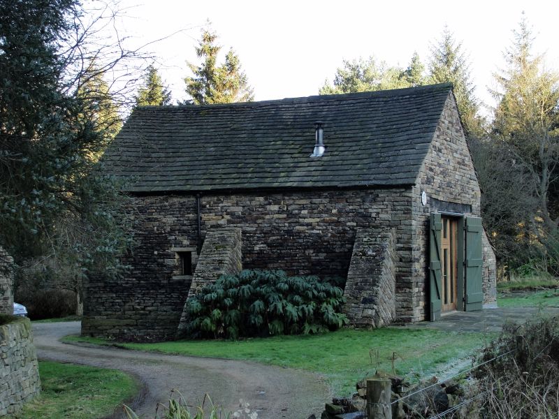
Entry Name: Dwarriden Cruck Barn, Approximately 200 Metres South East of Junction with Rushy Lane and Mill Lane
Listing Date: 8 August 1985
Grade: II
Source: Historic England
Source ID: 1132876
English Heritage Legacy ID: 335357
ID on this website: 101132876
Location: Wigtwizzle, Sheffield, South Yorkshire, S36
County: Sheffield
Civil Parish: Bradfield
Traditional County: Yorkshire
Lieutenancy Area (Ceremonial County): South Yorkshire
Church of England Parish: Bradfield St Nicholas
Church of England Diocese: Sheffield
Tagged with: Barn
SK25839561 BRADFIELD DWARRIDEN LANE SK29SE
4/34 Dwarriden Cruck Barn, approximately 200m south-east of junction with Rushy Lane and Mill Lane.
II
Barn. Probably C17, south gable rebuilt C20. Internal timber framing, dry-walled thinly-coursed sandstone, stone slate roof. One cruck bay with additional bay to north bounded by stone gable, both bays aisled to the east side. Plinth, very long quoins. South gable has large opening with mortared quoins and wood lintel. 2 mortared buttresses to west wall. Square vents to north gable. Interior: 2 cruck pairs, lofty and set on high stylobates on the aisle side and raised within the walling on the west side. Western blades have slight ogee profile. Wall posts rise from the eastern blades to support a soffit-morticed arcade plate. Tie beams above purlin level, Southern pair also has wall tie, Northern pair has halvings for spurs (one spur present) and halvings for a low tie beam, Single purlin with additional purlin to aisle, some windbraces, square-set ridge on saddle apex. Truncation of the south end of the building evidenced by empty scarf joint to arcade plate. Illustrated in C. F. Innocent, The Development of English Building Construction, 1916 p49.
Listing NGR: SK2583895612
External links are from the relevant listing authority and, where applicable, Wikidata. Wikidata IDs may be related buildings as well as this specific building. If you want to add or update a link, you will need to do so by editing the Wikidata entry.


Other nearby listed buildings