Latitude: 53.7915 / 53°47'29"N
Longitude: -1.8474 / 1°50'50"W
OS Eastings: 410152
OS Northings: 432807
OS Grid: SE101328
Mapcode National: GBR HSJL.VL
Mapcode Global: WHC97.LYJR
Plus Code: 9C5WQ5R3+H3
Entry Name: 23-31, Sapgate Lane BD13
Listing Date: 9 August 1983
Grade: II
Source: Historic England
Source ID: 1133736
English Heritage Legacy ID: 337093
ID on this website: 101133736
Location: Thornton, Bradford, West Yorkshire, BD13
County: Bradford
Electoral Ward/Division: Thornton and Allerton
Parish: Non Civil Parish
Built-Up Area: Thornton (Bradford)
Traditional County: Yorkshire
Lieutenancy Area (Ceremonial County): West Yorkshire
Church of England Parish: Thornton St James
Church of England Diocese: Leeds
Tagged with: Building
1. 5111 SAPGATE LANE Thornton BD13
Nos 23 to 31 (odd) SE 1032 39/1022
II GV
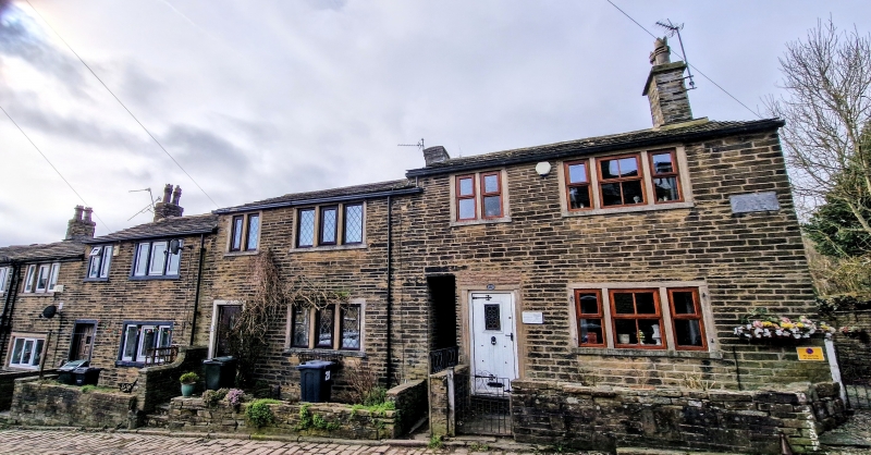
2. Circa 1800-20 cottage row to north of Nos 15 to 21 (odd) (q.v.). Sandstone "brick" with stone slate roof, corniced chimneys. Two and 3 light square mullion windows in squared surrounds, some altered. Squared jamb doorways. Included for group value.
Listing NGR: SE1015232807
External links are from the relevant listing authority and, where applicable, Wikidata. Wikidata IDs may be related buildings as well as this specific building. If you want to add or update a link, you will need to do so by editing the Wikidata entry.


Other nearby listed buildings