Latitude: 53.6492 / 53°38'57"N
Longitude: -1.7895 / 1°47'22"W
OS Eastings: 414012
OS Northings: 416992
OS Grid: SE140169
Mapcode National: GBR HVY7.CL
Mapcode Global: WHCB1.HJ2S
Plus Code: 9C5WJ6X6+M6
Entry Name: Wall in Front of Number 112
Listing Date: 29 September 1978
Grade: II
Source: Historic England
Source ID: 1134229
English Heritage Legacy ID: 339862
ID on this website: 101134229
Location: Newtown, Kirklees, West Yorkshire, HD1
County: Kirklees
Electoral Ward/Division: Newsome
Parish: Non Civil Parish
Built-Up Area: Huddersfield
Traditional County: Yorkshire
Lieutenancy Area (Ceremonial County): West Yorkshire
Church of England Parish: Huddersfield Holy Trinity
Church of England Diocese: Leeds
Tagged with: Wall
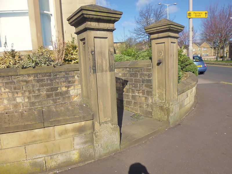
FITZWILLIAM STREET 1. 5113 (North Side) Wall in front of No 112 SE 1416 NW 1/536 SE 1417 28/536 II GV 2. Mid C19. Ashlar. Dwarf. Panelled piers with corniced capitals. Cast iron railings with spear and urn finials.
Listing NGR: SE1401216992
External links are from the relevant listing authority and, where applicable, Wikidata. Wikidata IDs may be related buildings as well as this specific building. If you want to add or update a link, you will need to do so by editing the Wikidata entry.


Other nearby listed buildings