Approximate Location Map
Large Map »
Latitude: 53.6419 / 53°38'30"N
Longitude: -1.7995 / 1°47'58"W
OS Eastings: 413352
OS Northings: 416177
OS Grid: SE133161
Mapcode National: GBR HVWB.66
Mapcode Global: WHCB1.BQBD
Plus Code: 9C5WJ6R2+Q5
Entry Name: 5, Colne Street
Listing Date: 29 September 1978
Grade: II
Source: Historic England
Source ID: 1134293
English Heritage Legacy ID: 339717
ID on this website: 101134293
Location: Thornton Lodge, Kirklees, West Yorkshire, HD1
County: Kirklees
Electoral Ward/Division: Greenhead
Parish: Non Civil Parish
Built-Up Area: Huddersfield
Traditional County: Yorkshire
Lieutenancy Area (Ceremonial County): West Yorkshire
Church of England Parish: Huddersfield All Saints and St Thomas
Church of England Diocese: Leeds
Tagged with: Building
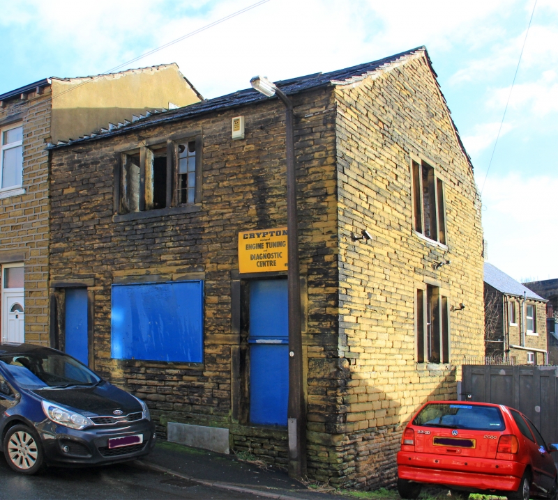
COLNE STREET
1.
5113
(East Side)
Lower Fold
No 5
SE 1316 33/386
II
2.
Early C19. Hammer-dressed stone. Pitched stone slate roof. 2 storeys. One
range of 3-light stone mullioned sashes with glazing bars. South end has one
range of 3-light stone mullioned windows with central lintel higher than other
2.
Listing NGR: SE1335216177
External links are from the relevant listing authority and, where applicable, Wikidata. Wikidata IDs may be related buildings as well as this specific building. If you want to add or update a link, you will need to do so by editing the Wikidata entry.


Other nearby listed buildings
