Approximate Location Map
Large Map »
Latitude: 53.6418 / 53°38'30"N
Longitude: -1.7852 / 1°47'6"W
OS Eastings: 414299
OS Northings: 416162
OS Grid: SE142161
Mapcode National: GBR HVZB.98
Mapcode Global: WHCB1.KQ4H
Plus Code: 9C5WJ6R7+PW
Entry Name: 36, Chapel Hill
Listing Date: 29 September 1978
Grade: II
Source: Historic England
Source ID: 1134316
English Heritage Legacy ID: 339670
ID on this website: 101134316
Location: Folly Hall, Kirklees, West Yorkshire, HD1
County: Kirklees
Electoral Ward/Division: Newsome
Parish: Non Civil Parish
Built-Up Area: Huddersfield
Traditional County: Yorkshire
Lieutenancy Area (Ceremonial County): West Yorkshire
Church of England Parish: Huddersfield All Saints and St Thomas
Church of England Diocese: Leeds
Tagged with: Building
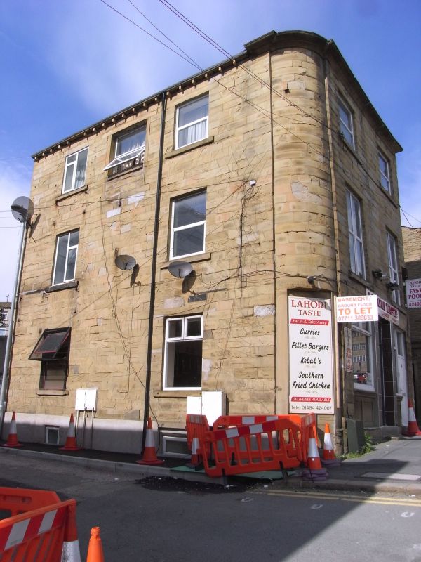
CHAPEL HILL
1.
5113
(West Side)
No 36
SE 1416 SW 3/329
II
2.
Mid C19. Painted ashlar. Hipped slate roof. 3 storeys. Moulded eaves cornice.
Curved corner. 2 ranges of sashes. Door with 4 moulded panels and fanlight.
Above this is large wooden panel with moulded cornice, and scrolls with ferns
either side.
Listing NGR: SE1429916162
External links are from the relevant listing authority and, where applicable, Wikidata. Wikidata IDs may be related buildings as well as this specific building. If you want to add or update a link, you will need to do so by editing the Wikidata entry.


Other nearby listed buildings
