Latitude: 53.6599 / 53°39'35"N
Longitude: -1.7963 / 1°47'46"W
OS Eastings: 413557
OS Northings: 418174
OS Grid: SE135181
Mapcode National: GBR HVW3.XR
Mapcode Global: WHCB1.C8VL
Plus Code: 9C5WM653+XF
Entry Name: Birkby Grange
Listing Date: 28 August 1977
Grade: II
Source: Historic England
Source ID: 1134388
English Heritage Legacy ID: 339537
ID on this website: 101134388
Location: Birkby, Kirklees, West Yorkshire, HD2
County: Kirklees
Electoral Ward/Division: Greenhead
Parish: Non Civil Parish
Built-Up Area: Huddersfield
Traditional County: Yorkshire
Lieutenancy Area (Ceremonial County): West Yorkshire
Church of England Parish: St John the Evangelist Huddersfield
Church of England Diocese: Leeds
Tagged with: Building
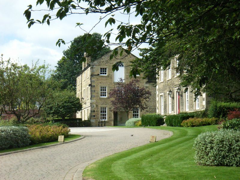
BIRKBY HALL ROAD 1. 5113 (South Side) Birkby Grange SE 1318 21/187 28.8.77. II 2. Mid C18. Hammer-dressed stone. Pitched stone slate roof. Coped gables on cut kneelers with ball finials. 2 storeys. Stone brackets to gutter. 5 ranges of casements with glazing bars in plain raised surrounds. Door with oblong fanlight and glazing bars in moulded stone surround of the Wilton type, with pulvinated frieze and cornice. East end has 2 ranges of casements with glazing bars and one Venetian window with Gothick glazing bars at attic level. West end has Diocletian window with glazing bars at attic level and 2 storey extension with glazed loggia on south side, incorporating 4 columns of apparently C18 or C19 date.
Listing NGR: SE1355718174
External links are from the relevant listing authority and, where applicable, Wikidata. Wikidata IDs may be related buildings as well as this specific building. If you want to add or update a link, you will need to do so by editing the Wikidata entry.


Other nearby listed buildings