Latitude: 53.6322 / 53°37'55"N
Longitude: -1.7974 / 1°47'50"W
OS Eastings: 413491
OS Northings: 415095
OS Grid: SE134150
Mapcode National: GBR HVWF.NP
Mapcode Global: WHCB1.CY9V
Plus Code: 9C5WJ6J3+V2
Entry Name: 65, Bentley Street
Listing Date: 29 September 1978
Grade: II
Source: Historic England
Source ID: 1134421
English Heritage Legacy ID: 339522
ID on this website: 101134421
Location: Lockwood, Kirklees, West Yorkshire, HD1
County: Kirklees
Electoral Ward/Division: Crosland Moor and Netherton
Parish: Non Civil Parish
Built-Up Area: Huddersfield
Traditional County: Yorkshire
Lieutenancy Area (Ceremonial County): West Yorkshire
Church of England Parish: South Crosland Holy Trinity
Church of England Diocese: Leeds
Tagged with: Building
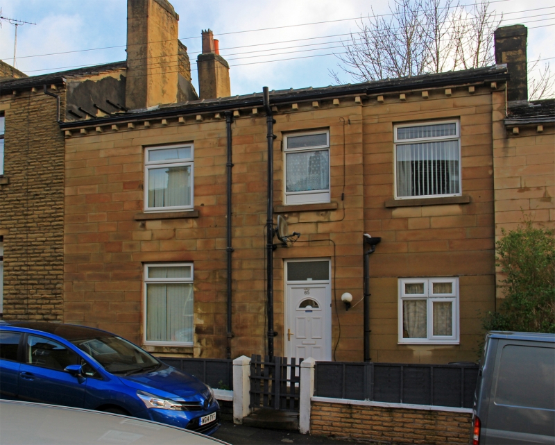
BENTLEY STREET
1.
5113
(East Side)
Lockwood
No 65
SE 1315 38/169
II
2.
Mid C19. Ashlar. Pitched stone slate roof. 2 storeys. Stone brackets to
gutter. 3 sashes on 1st floor, one on ground floor.
Listing NGR: SE1349115095
External links are from the relevant listing authority and, where applicable, Wikidata. Wikidata IDs may be related buildings as well as this specific building. If you want to add or update a link, you will need to do so by editing the Wikidata entry.


Other nearby listed buildings