Latitude: 53.5753 / 53°34'31"N
Longitude: -1.7704 / 1°46'13"W
OS Eastings: 415300
OS Northings: 408774
OS Grid: SE153087
Mapcode National: GBR JW23.H2
Mapcode Global: WHCBF.SD4F
Plus Code: 9C5WH6GH+4R
Entry Name: 72, 74, Wooldale Road
Listing Date: 4 August 1983
Grade: II
Source: Historic England
Source ID: 1134750
English Heritage Legacy ID: 340663
ID on this website: 101134750
Location: Wooldale, Kirklees, West Yorkshire, HD9
County: Kirklees
Civil Parish: Holme Valley
Built-Up Area: Holmfirth
Traditional County: Yorkshire
Lieutenancy Area (Ceremonial County): West Yorkshire
Church of England Parish: Holmfirth Holy Trinity
Church of England Diocese: Leeds
Tagged with: Building
SE 15 08 WOOLDALE ROAD 13/435 (Wooldale)
Nos 72 and 74 GV II
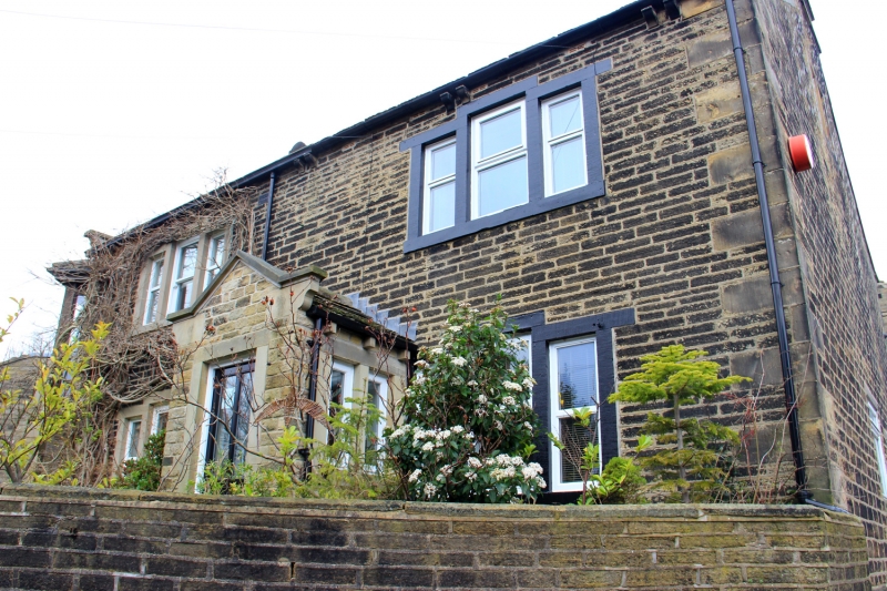
Pair of houses. Mid C19 possibly earlier. Hammer dressed stone. Quoins. Stone slate roof with 2 ashlar stacks (one altered). Gable copings on carved kneelers. Two storeys. Two bays of 3-light stone mullioned windows with stepped lintels, and doorway in recent porch. Left gable wall has entrance in recent porch.
Listing NGR: SE1530008774
External links are from the relevant listing authority and, where applicable, Wikidata. Wikidata IDs may be related buildings as well as this specific building. If you want to add or update a link, you will need to do so by editing the Wikidata entry.


Other nearby listed buildings