Approximate Location Map
Large Map »
Latitude: 53.659 / 53°39'32"N
Longitude: -1.843 / 1°50'34"W
OS Eastings: 410469
OS Northings: 418066
OS Grid: SE104180
Mapcode National: GBR HVK4.S2
Mapcode Global: WHCB0.N9K9
Plus Code: 9C5WM554+HQ
Entry Name: 62, Laund Road
Listing Date: 29 September 1978
Grade: II
Source: Historic England
Source ID: 1134992
English Heritage Legacy ID: 340112
ID on this website: 101134992
Location: Salendine Nook, Kirklees, West Yorkshire, HD3
County: Kirklees
Electoral Ward/Division: Lindley
Parish: Non Civil Parish
Built-Up Area: Huddersfield
Traditional County: Yorkshire
Lieutenancy Area (Ceremonial County): West Yorkshire
Church of England Parish: Lindley St Stephen
Church of England Diocese: Leeds
Tagged with: Building
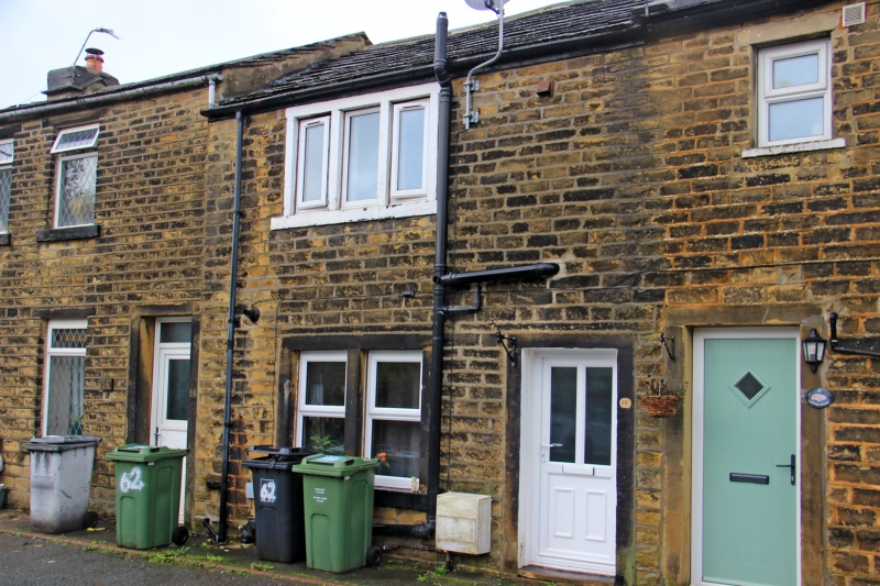
LAUND ROAD
1.
5113
(East Side)
Salendine Nook
No 62
SE 1018 20/784
II
2.
C18 or early C19. Hammer-dressed stone. Pitched stone slate roof. Coped
gable. 2 storeys. One 3-light stone mullioned window on 1st floor. One bipartite
stone mullioned window with glazing bars on ground floor.
Listing NGR: SE1046918066
External links are from the relevant listing authority and, where applicable, Wikidata. Wikidata IDs may be related buildings as well as this specific building. If you want to add or update a link, you will need to do so by editing the Wikidata entry.


Other nearby listed buildings
