Latitude: 53.6455 / 53°38'43"N
Longitude: -1.7798 / 1°46'47"W
OS Eastings: 414652
OS Northings: 416575
OS Grid: SE146165
Mapcode National: GBR JV08.GX
Mapcode Global: WHCB1.MMPN
Plus Code: 9C5WJ6WC+53
Entry Name: 2 Wormalds Yard
Listing Date: 29 September 1978
Grade: II
Source: Historic England
Source ID: 1135009
English Heritage Legacy ID: 340057
ID on this website: 101135009
Location: Huddersfield, Kirklees, West Yorkshire, HD1
County: Kirklees
Electoral Ward/Division: Newsome
Parish: Non Civil Parish
Built-Up Area: Huddersfield
Traditional County: Yorkshire
Lieutenancy Area (Ceremonial County): West Yorkshire
Church of England Parish: Huddersfield St Peter
Church of England Diocese: Leeds
Tagged with: Building
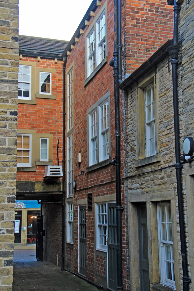
KING STREET
1.
5113
(South Side)
Wormald's Yard No 2
SE 1416 NE 2/731
II GV
2.
Early C19. Red brick. Pitched stone slate roof. 3 storeys. Stone brackets to gutter. 1 range of bipartite stone mullioned sashes with glazing bars. Stone setts in yard outside.
Listing NGR: SE1465216575
External links are from the relevant listing authority and, where applicable, Wikidata. Wikidata IDs may be related buildings as well as this specific building. If you want to add or update a link, you will need to do so by editing the Wikidata entry.


Other nearby listed buildings