Latitude: 50.6454 / 50°38'43"N
Longitude: -2.4173 / 2°25'2"W
OS Eastings: 370587
OS Northings: 82945
OS Grid: SY705829
Mapcode National: GBR PZ.H19B
Mapcode Global: FRA 57TC.J1W
Plus Code: 9C2VJHWM+53
Entry Name: Group of 5 Monuments Approximately 10 Metres South of Aisle Window to Church of St Andrew
Listing Date: 22 December 1997
Grade: II
Source: Historic England
Source ID: 1135151
English Heritage Legacy ID: 467339
ID on this website: 101135151
Location: St Andrew's Church, Preston, Dorset, DT3
County: Dorset
Electoral Ward/Division: Preston
Parish: Weymouth
Built-Up Area: Weymouth
Traditional County: Dorset
Lieutenancy Area (Ceremonial County): Dorset
Church of England Parish: Preston with Sutton Poyntz St Andrew
Church of England Diocese: Salisbury
Tagged with: Monument
WEYMOUTH
SY78SW CHURCH ROAD, Preston 873-1/3/470 (South side) Group of 5 monuments approx 10m S of aisle W window to Church of St Andrew
GV II
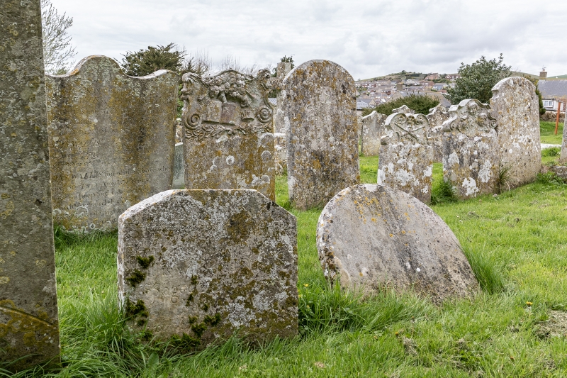
5 headstones. Early to mid C18, dated variously from 1756 to 1770. The stones are grouped in 2 pairs, separated by approx 2m N/S, and a single monument approx 2m to the E, between the pairs. From N to S they are: (i) Early C18, unidentified, the inscriptions not legible. There are 3 good carved cherub heads under a shaped top, above a flush panel; (ii) Immediately S of the last. C18, with shaped head to scrolls. Carved skull, trumpet and torch, above a flush panel with no legible inscription; (iii) approx 2m S of the last. To Richard Lewis, d.1761. Shaped top with scrolls above carved book and other symbols including an angel; (iv) Immediately S of the last. A very wide headstone, with shaped top, and with inscriptions covering most of the surface, starting very close to the top. The earliest decipherable memorial is to Joseph Wallis, d.1770; (v) approx 2m E from and centred to the previous pairs, a small headstone to Richard Johnson, d.1756. Shaped top.
Listing NGR: SY7058782945
External links are from the relevant listing authority and, where applicable, Wikidata. Wikidata IDs may be related buildings as well as this specific building. If you want to add or update a link, you will need to do so by editing the Wikidata entry.


Other nearby listed buildings