Latitude: 53.904 / 53°54'14"N
Longitude: -1.6914 / 1°41'29"W
OS Eastings: 420373
OS Northings: 445364
OS Grid: SE203453
Mapcode National: GBR JRM9.M7
Mapcode Global: WHC8X.Z4RF
Plus Code: 9C5WW835+JC
Entry Name: 40, Bondgate
Listing Date: 8 July 1974
Grade: II
Source: Historic England
Source ID: 1135286
English Heritage Legacy ID: 341375
ID on this website: 101135286
Location: Otley, Leeds, West Yorkshire, LS21
County: Leeds
Civil Parish: Otley
Built-Up Area: Otley
Traditional County: Yorkshire
Lieutenancy Area (Ceremonial County): West Yorkshire
Church of England Parish: Otley All Saints
Church of England Diocese: Leeds
Tagged with: Building
Bondgate
1.
1480
(North Side)
No 40
SE 2045 1/117
II GV
2.
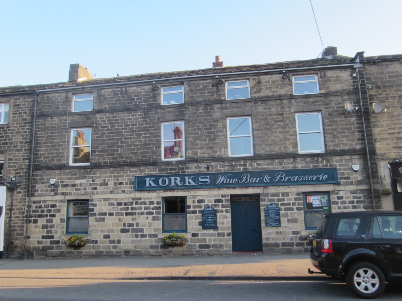
Early C19. 3 storeys in stone with stone slate roof. 4 windows, hung
sashes with glazing bars, band continues cills, stone flat arches, Modern
shop front.
Nos 10 to 35 (even) and 38 to 44 (even) form a group.
Listing NGR: SE2037345364
External links are from the relevant listing authority and, where applicable, Wikidata. Wikidata IDs may be related buildings as well as this specific building. If you want to add or update a link, you will need to do so by editing the Wikidata entry.


Other nearby listed buildings