Approximate Location Map
Large Map »
Latitude: 53.8305 / 53°49'49"N
Longitude: -1.3428 / 1°20'34"W
OS Eastings: 443349
OS Northings: 437334
OS Grid: SE433373
Mapcode National: GBR MS24.2M
Mapcode Global: WHDBF.BZSC
Plus Code: 9C5WRMJ4+5V
Entry Name: Aberford Bridge
Listing Date: 3 December 1986
Grade: II
Source: Historic England
Source ID: 1135615
English Heritage Legacy ID: 342230
ID on this website: 101135615
Location: Aberford, Leeds, West Yorkshire, LS25
County: Leeds
Civil Parish: Aberford
Built-Up Area: Aberford
Traditional County: Yorkshire
Lieutenancy Area (Ceremonial County): West Yorkshire
Church of England Parish: Aberford St Ricarius
Church of England Diocese: York
Tagged with: Bridge
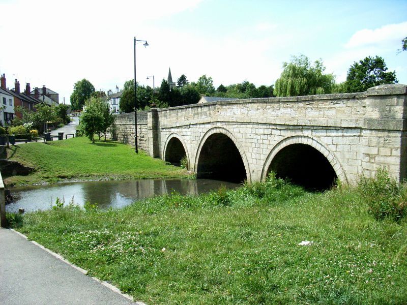
ABERFORD MAIN STREET
SE43NW
LS25
2/13 Aberford Bridge
GV II
Public road bridge. Probably late C18. Squared magnesian limestone. Three
spans. Segmental arches with slightly recessed voussoirs and arch bands,
plain string course rising to very shallow apex in centre, coped parapet,
and projecting piers at the ends.
Listing NGR: SE4334937334
External links are from the relevant listing authority and, where applicable, Wikidata. Wikidata IDs may be related buildings as well as this specific building. If you want to add or update a link, you will need to do so by editing the Wikidata entry.


Other nearby listed buildings
