Latitude: 51.4836 / 51°29'0"N
Longitude: -1.2393 / 1°14'21"W
OS Eastings: 452921
OS Northings: 176347
OS Grid: SU529763
Mapcode National: GBR 927.ZFS
Mapcode Global: VHCZ0.GZQ1
Plus Code: 9C3WFQM6+C7
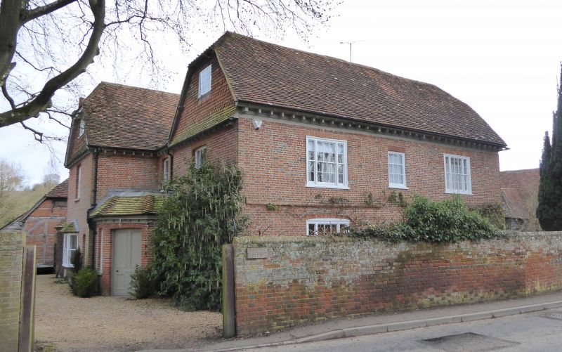
Entry Name: Parsonage House
Listing Date: 24 November 1966
Grade: II
Source: Historic England
Source ID: 1135730
English Heritage Legacy ID: 39925
ID on this website: 101135730
Location: Hampstead Norreys, West Berkshire, RG18
County: West Berkshire
Civil Parish: Hampstead Norreys
Built-Up Area: Hampstead Norreys
Traditional County: Berkshire
Lieutenancy Area (Ceremonial County): Berkshire
Church of England Parish: Hampstead Norreys
Church of England Diocese: Oxford
Tagged with: House
HAMPSTEAD NORREYS CHURCH STREET SU 57 NW (North east side)
9/16 Parsonage House 24.11.66 G.V. II
House. Early C18 extended late C19. Vitreous brick, half hipped old tile roof,tile hung gable. Rectangular plan with C19 gabled and C20 flat roofed extensions on north and C19 entry in angle between 2 storeys and attic. 2 chimneys with offset heads on south east roof slope of extension. Moulded first floor string, bracketed wood cornice Sash windows with glazing bars and rubbed brick heads, similar windows on gable end, but without glazing bars. South front:- 3 bays, the outer sashes tripartite, the former central door now a window.
Listing NGR: SU5295376338
External links are from the relevant listing authority and, where applicable, Wikidata. Wikidata IDs may be related buildings as well as this specific building. If you want to add or update a link, you will need to do so by editing the Wikidata entry.


Other nearby listed buildings