Approximate Location Map
Large Map »
Latitude: 51.4024 / 51°24'8"N
Longitude: -0.8037 / 0°48'13"W
OS Eastings: 483313
OS Northings: 167725
OS Grid: SU833677
Mapcode National: GBR D7Z.1MT
Mapcode Global: VHDX9.00ZQ
Plus Code: 9C3XC52W+XG
Entry Name: Lock's Barn
Listing Date: 26 January 1967
Grade: II
Source: Historic England
Source ID: 1135838
English Heritage Legacy ID: 41539
ID on this website: 101135838
Location: Holme Green, Wokingham, Berkshire, RG40
County: Wokingham
Civil Parish: Wokingham Without
Traditional County: Berkshire
Lieutenancy Area (Ceremonial County): Berkshire
Church of England Parish: Wokingham
Church of England Diocese: Oxford
Tagged with: Barn
SU 86 NW
10/3
26.1.67
WOKINGHAM WITHOUT
WATERLOO ROAD
(south side)
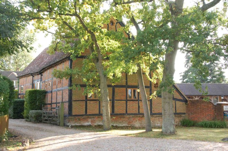
Lock's Barn
G.V.
II
Barn now domestic storage. Early C18. Timber framed and weatherboarded,
thatched gabled roof. 5 framed bays, aisle on west side, with gabled
central wagon entrance. Queen post roof trusses, straight braces
and later floors inserted over 2 end bays on north.
Listing NGR: SU8331367725
External links are from the relevant listing authority and, where applicable, Wikidata. Wikidata IDs may be related buildings as well as this specific building. If you want to add or update a link, you will need to do so by editing the Wikidata entry.


Other nearby listed buildings
