Latitude: 51.4665 / 51°27'59"N
Longitude: -0.8439 / 0°50'38"W
OS Eastings: 480404
OS Northings: 174807
OS Grid: SU804748
Mapcode National: GBR C5M.X2K
Mapcode Global: VHDWW.BD7L
Plus Code: 9C3XF584+JC
Entry Name: Wall 30 Metres to North East of Hinton House
Listing Date: 17 October 1983
Grade: II
Source: Historic England
Source ID: 1136078
English Heritage Legacy ID: 41238
ID on this website: 101136078
Location: Wokingham, Berkshire, RG10
County: Wokingham
Civil Parish: St. Nicholas, Hurst
Traditional County: Berkshire
Lieutenancy Area (Ceremonial County): Berkshire
Church of England Parish: Hurst
Church of England Diocese: Oxford
Tagged with: Wall
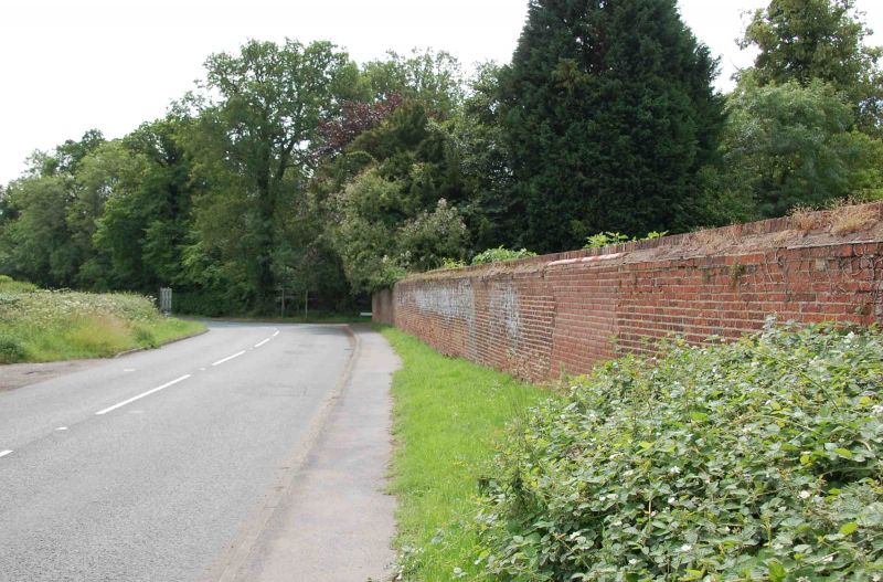
SU 87SW ST NICHOLAS HUBST HINTON ROAD
(north side)
6/2 Wall 30 Metres To
North East Of
Hinton House
GV II
Brick wall. C17 brick with simple brick on edge coping, approximately 60 metres
long, 2 metres high forming north boundary to garden of Hinton House.
Listing NGR: SU8040474807
External links are from the relevant listing authority and, where applicable, Wikidata. Wikidata IDs may be related buildings as well as this specific building. If you want to add or update a link, you will need to do so by editing the Wikidata entry.


Other nearby listed buildings