Latitude: 51.5473 / 51°32'50"N
Longitude: -2.3512 / 2°21'4"W
OS Eastings: 375745
OS Northings: 183218
OS Grid: ST757832
Mapcode National: GBR 0ND.SH3
Mapcode Global: VH95V.6CDN
Plus Code: 9C3VGJWX+WG
Entry Name: Wall Enclosing West and South Sides of Little Sodbury Churchyard, Church of St Adeline
Listing Date: 5 June 1984
Grade: II
Source: Historic England
Source ID: 1136838
English Heritage Legacy ID: 34716
ID on this website: 101136838
Location: St Adeline's Church, Little Sodbury, South Gloucestershire, BS37
County: South Gloucestershire
Civil Parish: Little Sodbury
Traditional County: Gloucestershire
Lieutenancy Area (Ceremonial County): Gloucestershire
Church of England Parish: Little Sodbury St Adeline
Church of England Diocese: Gloucester
Tagged with: Wall
ST 78 SE
8/91
LITTLE SODBURY
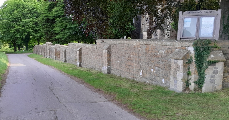
Wall enclosing west and south sides of Little Sodbury churchyard, Church of St. Adeline
G.V.
II
Walls, gates and gatepiers. Circa 1859. Coursed rubble walls with ashlar
coping; stepped up and with buttresses at intervals. Plain gatepiers to centre
of west side; gatepiers to south are capped by cusped gablets. The enclosing
walls add considerably to the setting of the church.
Listing NGR: ST7574583218
External links are from the relevant listing authority and, where applicable, Wikidata. Wikidata IDs may be related buildings as well as this specific building. If you want to add or update a link, you will need to do so by editing the Wikidata entry.


Other nearby listed buildings