Latitude: 51.595 / 51°35'42"N
Longitude: -2.4001 / 2°24'0"W
OS Eastings: 372383
OS Northings: 188538
OS Grid: ST723885
Mapcode National: GBR JZ.BQZG
Mapcode Global: VH95M.C51L
Plus Code: 9C3VHHWX+2X
Entry Name: 24, High Street
Listing Date: 5 June 1984
Grade: II
Source: Historic England
Source ID: 1137303
English Heritage Legacy ID: 34815
ID on this website: 101137303
Location: Wickwar, South Gloucestershire, GL12
County: South Gloucestershire
Civil Parish: Wickwar
Built-Up Area: Wickwar
Traditional County: Gloucestershire
Lieutenancy Area (Ceremonial County): Gloucestershire
Church of England Parish: Wickwar Holy Trinity
Church of England Diocese: Gloucester
Tagged with: Building
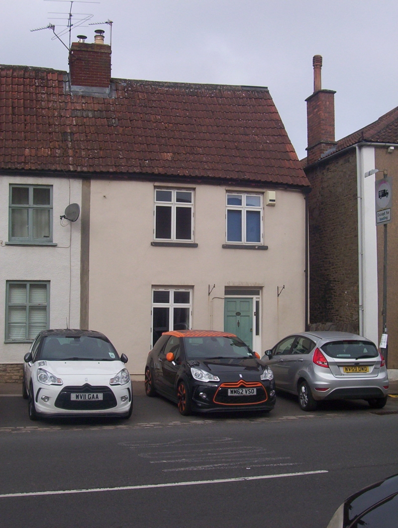
ST 7288 WICKWAR HIGH STREET (west side)
9/191 No. 24
G.V. II
House, in the village street. C18, remodelling of a C17 house. Rendered;
double Roman tiled roof; rendered stacks. 2 storeys. 2 bays: C20 2-light
cross windows. C20 door to right. Included for group value.
Listing NGR: ST7238388538
External links are from the relevant listing authority and, where applicable, Wikidata. Wikidata IDs may be related buildings as well as this specific building. If you want to add or update a link, you will need to do so by editing the Wikidata entry.


Other nearby listed buildings