Approximate Location Map
Large Map »
Latitude: 54.7173 / 54°43'2"N
Longitude: -3.4967 / 3°29'48"W
OS Eastings: 303683
OS Northings: 536841
OS Grid: NY036368
Mapcode National: GBR 4F0W.RR
Mapcode Global: WH5YB.8P4H
Plus Code: 9C6RPG83+W8
Entry Name: 1, Camp Street
Listing Date: 27 May 1977
Grade: II
Source: Historic England
Source ID: 1137469
English Heritage Legacy ID: 71806
ID on this website: 101137469
Location: Maryport, Cumberland, Cumbria, CA15
County: Cumbria
District: Allerdale
Civil Parish: Maryport
Built-Up Area: Maryport
Traditional County: Cumberland
Lieutenancy Area (Ceremonial County): Cumbria
Church of England Parish: Maryport St Mary with Christ Church
Church of England Diocese: Carlisle
Tagged with: Building
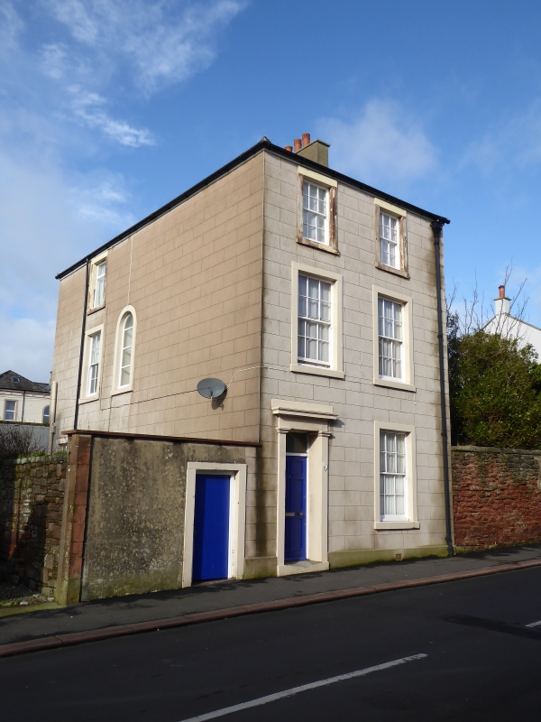
MARYPORT CAMP STREET
1.
5161 (West Side)
-----------
No 1
NY 0336 1/26
II GV
2.
Early C19. 3 storeys, cement rendered, with 2 windows to each storey, hung
sashes with glazing bars. Stone surround to 1 window to ground floor and panelled
door in pilastered surround with entablature and cornice.
Listing NGR: NY0368336841
External links are from the relevant listing authority and, where applicable, Wikidata. Wikidata IDs may be related buildings as well as this specific building. If you want to add or update a link, you will need to do so by editing the Wikidata entry.


Other nearby listed buildings
