Latitude: 51.3535 / 51°21'12"N
Longitude: -2.9676 / 2°58'3"W
OS Eastings: 332716
OS Northings: 162044
OS Grid: ST327620
Mapcode National: GBR J7.TSB6
Mapcode Global: VH7CK.J70R
Plus Code: 9C3V923J+9X
Entry Name: Cemetery Chapel
Listing Date: 19 May 1983
Grade: II
Source: Historic England
Source ID: 1137535
English Heritage Legacy ID: 33189
ID on this website: 101137535
Location: North Somerset, BS23
County: North Somerset
Civil Parish: Weston-super-Mare
Built-Up Area: Weston-Super-Mare
Traditional County: Somerset
Lieutenancy Area (Ceremonial County): Somerset
Tagged with: Chapel
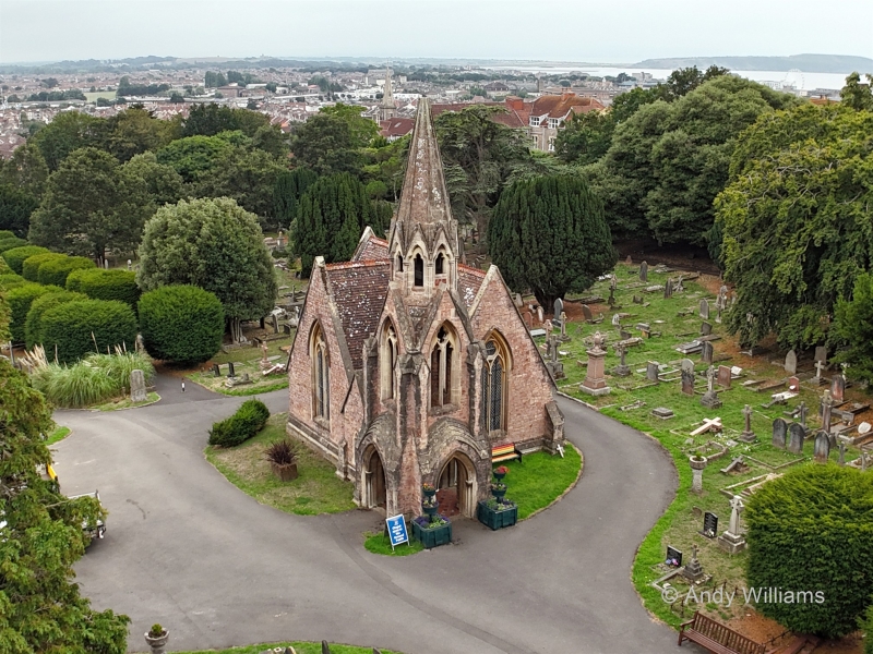
BRISTOL ROAD LOWER 1. 5121 Cemetery Chapel ST 36 SW 1/29 II 2. 1856 by C E Davis Bath. Squared sandstone rubble with limestone dressings. Tiled roof. Asymmetrical plan. Three stage buttressed tower at NE corner, with ground floor open as porch on 3 sides; 2 light unglazed windows; hexagonal ashlar spire. Gabled porch to W. (Originally one of a pair of chapels with central spire).
Listing NGR: ST3271662044
External links are from the relevant listing authority and, where applicable, Wikidata. Wikidata IDs may be related buildings as well as this specific building. If you want to add or update a link, you will need to do so by editing the Wikidata entry.


Other nearby listed buildings