Approximate Location Map
Large Map »
Latitude: 54.9175 / 54°55'3"N
Longitude: -2.8196 / 2°49'10"W
OS Eastings: 347558
OS Northings: 558401
OS Grid: NY475584
Mapcode National: GBR 8CRK.CZ
Mapcode Global: WH7ZY.NNJH
Plus Code: 9C6VW59J+24
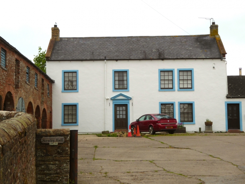
Entry Name: Newby Hall
Listing Date: 16 January 1984
Grade: II
Source: Historic England
Source ID: 1137960
English Heritage Legacy ID: 77902
ID on this website: 101137960
Location: Newby East, Cumberland, Cumbria, CA4
County: Cumbria
District: Carlisle
Civil Parish: Irthington
Traditional County: Cumberland
Lieutenancy Area (Ceremonial County): Cumbria
Church of England Parish: Irthington St Kentigern
Church of England Diocese: Carlisle
Tagged with: Farmhouse
NY 45 NE IRTHINGTON NEWBY EAST
12/107 Newby Hall
II
Farmhouse. Mid C18. Rendered walls, stone dressings; Welsh slate roof with
coped gables, yellow brick chimney stacks. 2 storeys, 4 bays. Entrance has
moulded architrave and entablature with moulded triangular pediment. Sash
windows with glazing bars have painted stone surrounds. Listing does not
include the other adjoining farm buildings.
Listing NGR: NY4755858401
External links are from the relevant listing authority and, where applicable, Wikidata. Wikidata IDs may be related buildings as well as this specific building. If you want to add or update a link, you will need to do so by editing the Wikidata entry.


Other nearby listed buildings
