Latitude: 51.9956 / 51°59'44"N
Longitude: -0.4507 / 0°27'2"W
OS Eastings: 506468
OS Northings: 234151
OS Grid: TL064341
Mapcode National: GBR G3R.T1Q
Mapcode Global: VHFR1.43LH
Plus Code: 9C3XXGWX+6P
Entry Name: College Farmhouse
Listing Date: 3 May 1985
Grade: II
Source: Historic England
Source ID: 1137982
English Heritage Legacy ID: 38074
ID on this website: 101137982
Location: Pulloxhill, Central Bedfordshire, MK45
County: Central Bedfordshire
Civil Parish: Pulloxhill
Built-Up Area: Pulloxhill
Traditional County: Bedfordshire
Lieutenancy Area (Ceremonial County): Bedfordshire
Church of England Parish: Pulloxhill
Church of England Diocese: St.Albans
Tagged with: Farmhouse
PULLOXHILL
TL 0634 BARTON ROAD
18/87 College Farmhouse
- II
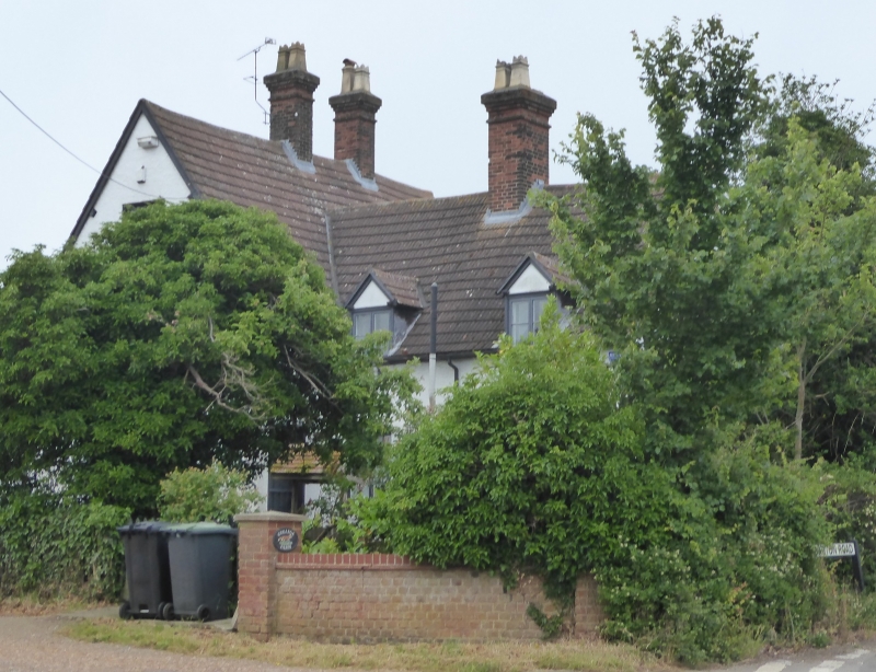
House. Probably C16, with extensions and alterations C17 to C19. Timber framed construction, that to main block substantial and close-studded. C20 tile roofs. Original structure 2-storeys and attics, 2-room plan, with small staircase gable projecting from centre of E elevation. 2-roomed, one storey and attics addition projects from W elevation, forming T-plan. C19 colourwashed brick additions with catslide roofs to SW and NE. Most windows are C20 replacement casements with glazing bars. Main entrance is to NW end of main block. 3 red brick ridge stacks, the pair to main block possibly replacing a central multiple one.
Listing NGR: TL0646834151
External links are from the relevant listing authority and, where applicable, Wikidata. Wikidata IDs may be related buildings as well as this specific building. If you want to add or update a link, you will need to do so by editing the Wikidata entry.


Other nearby listed buildings