Approximate Location Map
Large Map »
Latitude: 51.8886 / 51°53'18"N
Longitude: -0.5247 / 0°31'29"W
OS Eastings: 501625
OS Northings: 222145
OS Grid: TL016221
Mapcode National: GBR G50.D5B
Mapcode Global: VHFRC.VSGK
Plus Code: 9C3XVFQG+C4
Entry Name: 81, High Street North
Listing Date: 10 October 1974
Grade: II
Source: Historic England
Source ID: 1138261
English Heritage Legacy ID: 35745
ID on this website: 101138261
Location: Dunstable, Central Bedfordshire, LU6
County: Central Bedfordshire
Civil Parish: Dunstable
Built-Up Area: Dunstable
Traditional County: Bedfordshire
Lieutenancy Area (Ceremonial County): Bedfordshire
Church of England Parish: Dunstable
Church of England Diocese: St.Albans
Tagged with: Building
1.
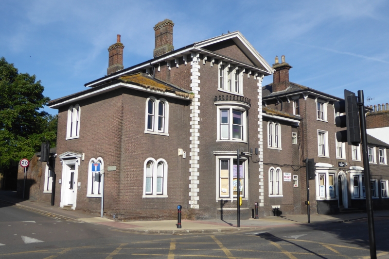
5125 HIGH STREET NORTH
(West Side)
No 81
TL 0122 3/88 10.10.74.
II
2.
Early to mid C19. Plum coloured brick, Welsh slated roofs with central pediment.
3 storey centre, recessed 2 storey wings. Central 2 storey bow, quoins. 2 light
round headed side windows in stone surrounds.
Listing NGR: TL0162522145
External links are from the relevant listing authority and, where applicable, Wikidata. Wikidata IDs may be related buildings as well as this specific building. If you want to add or update a link, you will need to do so by editing the Wikidata entry.


Other nearby listed buildings
