Latitude: 54.2769 / 54°16'36"N
Longitude: -3.2127 / 3°12'45"W
OS Eastings: 321135
OS Northings: 487485
OS Grid: SD211874
Mapcode National: GBR 6L0Z.8M
Mapcode Global: WH71Q.MRCM
Plus Code: 9C6R7QGP+QW
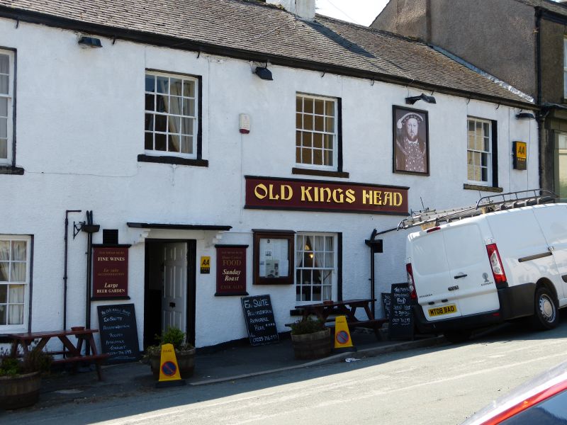
Entry Name: Old King's Head Public House
Listing Date: 5 March 1990
Grade: II
Source: Historic England
Source ID: 1138289
English Heritage Legacy ID: 75839
ID on this website: 101138289
Location: Broughton in Furness, Westmorland and Furness, Cumbria, LA20
County: Westmorland and Furness
District: South Lakeland
Civil Parish: Broughton West
Built-Up Area: Broughton in Furness
Traditional County: Lancashire
Lieutenancy Area (Ceremonial County): Cumbria
Church of England Parish: Broughton-in-Furness St Mary Magdalene
Church of England Diocese: Carlisle
Tagged with: Pub
BROUGHTON WEST STATION ROAD (south side) SD 2187 Broughton-in-Furness 23/68 Old King's Head Public House G.V. II
Public House. 1st mentioned as Church House in 1666 but probably mid C18. Roughcast stone with slate roof. 2 storeys, 6 bays. Ground floor has small-pared casement to 1st bay, sashed window with single glazing bars and horns to 2nd bay, 3rd and 5th bays have sashes with glazing bars, paired sash to 3rd bay; 6th bay has window with small-paned fixed glazing. 1st floor has sashed windows with glazing bars, 1st 2 with horns. Entrance to 4th bay has flat bracketed canopy and 6-panel door. Gable-end stack and cross-axial stacks. Rear has later outshuts.
Listing NGR: SD2113587485
External links are from the relevant listing authority and, where applicable, Wikidata. Wikidata IDs may be related buildings as well as this specific building. If you want to add or update a link, you will need to do so by editing the Wikidata entry.


Other nearby listed buildings