Latitude: 53.0806 / 53°4'50"N
Longitude: -2.3727 / 2°22'21"W
OS Eastings: 375129
OS Northings: 353770
OS Grid: SJ751537
Mapcode National: GBR 01S.T33
Mapcode Global: WH9B6.JTCQ
Plus Code: 9C5V3JJG+6W
Entry Name: Bridgehouse Farm House
Listing Date: 14 June 1984
Grade: II
Source: Historic England
Source ID: 1138665
English Heritage Legacy ID: 56660
ID on this website: 101138665
Location: Cheshire East, Cheshire, CW2
County: Cheshire East
Civil Parish: Crewe Green
Traditional County: Cheshire
Lieutenancy Area (Ceremonial County): Cheshire
Church of England Parish: Crewe Green St Michael
Church of England Diocese: Chester
Tagged with: Farmhouse
SJ 75 SE CREWE C.P. BARTHOMLEY ROAD
6/16 Bridgehouse Farm House
II
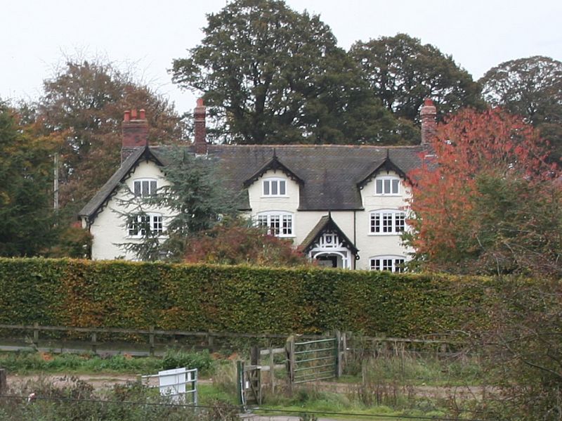
Originally farmhouse, now dwelling. Early C17 but remodelled by the Crewe Estate in 1875 (in porch apex). Roughcast brickwork with tiled roof. 2 storeys and attic, 3 bays including gable, "L" shaped plan. Oak studded door in projecting gabled porch with 3-light casements in flanking walls, corner posts, arched head, carved barge board with finial and apex framing containing Crewe Estate emblem and date. Three-light flush casements with glazing bars, timber sills and turning pieces ground floor and first floor. Two gabled dormers with 3-light casements and carved barge boards. Alternate bands of shaped tiles in roof slope. The south gable has sandstone plinth, C17 brickwork, corbelled string course and flush stone quoins. Interior: Deep bevelled beams and exposed joists, ovolo moulded beams in the south end, one heavy ovolo moulded door frame. Six panel doors. Original purlins and ridgetree.
Listing NGR: SJ7512953770
External links are from the relevant listing authority and, where applicable, Wikidata. Wikidata IDs may be related buildings as well as this specific building. If you want to add or update a link, you will need to do so by editing the Wikidata entry.


Other nearby listed buildings