Approximate Location Map
Large Map »
Latitude: 53.323 / 53°19'22"N
Longitude: -2.0098 / 2°0'35"W
OS Eastings: 399444
OS Northings: 380672
OS Grid: SJ994806
Mapcode National: GBR GZD0.PJ
Mapcode Global: WHBBC.3Q7X
Plus Code: 9C5V8XFR+53
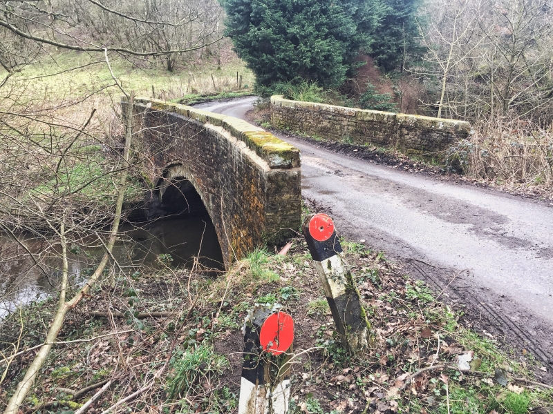
Entry Name: Kishfield Bridge
Listing Date: 29 September 1977
Last Amended: 9 December 1983
Grade: II
Source: Historic England
Source ID: 1138937
English Heritage Legacy ID: 57990
ID on this website: 101138937
Location: Kettleshulme, High Peak, Derbyshire, SK23
County: Derbyshire
District: High Peak
Civil Parish: Whaley Bridge
Traditional County: Cheshire
Lieutenancy Area (Ceremonial County): Cheshire
Church of England Parish: Whaley Bridge, Taxal St James
Church of England Diocese: Chester
Tagged with: Bridge
KETTLESHULME C.P. KISHFIELD LANE
SJ 98 SE 1/77
29/9/1977
Kishfield Bridge (formerly listed under Kishfield Road)
II
Bridge over Todd Brook: probably late C18. Coursed, square, brown, sandstone rubble. Slightly recessed, low segmental arch. Plain parapet has a flat coping.
Part of this bridge is in Derbyshire.
Listing NGR: SJ9944480672
External links are from the relevant listing authority and, where applicable, Wikidata. Wikidata IDs may be related buildings as well as this specific building. If you want to add or update a link, you will need to do so by editing the Wikidata entry.


Other nearby listed buildings
